
Gretna, Hm Factory, Eastriggs Explosives Factory Area, Road System


Road(S) (20th Century)
Site Name Gretna, Hm Factory, Eastriggs Explosives Factory Area, Road System
Classification Road(S) (20th Century)
Alternative Name(s) Hm Gretna Factory Site 3
Canmore ID 374933
Site Number NY26NW 46.22
NGR NY 26108 64812
NGR Description centred
Datum OSGB36 - NGR
Permalink http://canmore.org.uk/site/374933


- Council Dumfries And Galloway
- Parish Dornock
- Former Region Dumfries And Galloway
- Former District Annandale And Eskdale
- Former County Dumfries-shire
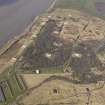
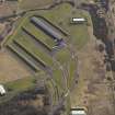
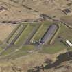
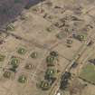
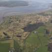
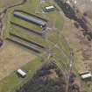
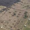
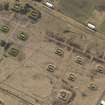
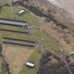
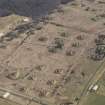
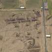
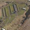
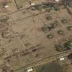
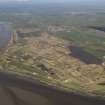
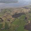
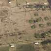
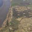
WWI and WWII explosives stores situated SW of Eastirggs. The site is still used by the Ministry of Defence, access is still restricted. The site forms part of a larger area for which see NY26SE 10.
J Guy 1999; NMRS MS 810/6, 102-103 (vol.1)
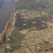
The explosives works and stores are visible on a series of RAF WW II oblique aerial photographs (F 309, 10572-10591, flown 26 January 1942), which show the general layout of the works. The works are also visible on more recent vertical air photographs (All Scotland Survey [Jasair], 507 88 140-142, flown 10 June 1988), which show that much of the site had been abandoned by that date.
Information from RCAHMS (DE), April 2006
The site is now mainly used for explosives storage. Many of the huts and buildings with enclosing earth banks survive and the site retains a railway connection from the main line from Dumfries to Kilmarnock to Glasgow.
Information from RCAHMS (DE), April 2010

