
Luing, Leccabuy


Farmstead(S) (19th Century), Township (Medieval) - (19th Century)
Site Name Luing, Leccabuy
Classification Farmstead(S) (19th Century), Township (Medieval) - (19th Century)
Alternative Name(s) Mid Leckabuy; South Leckabuy
Canmore ID 372665
Site Number NM70NW 76
NGR NM 74733 09768
NGR Description Centre
Datum OSGB36 - NGR
Permalink http://canmore.org.uk/site/372665

- Council Argyll And Bute
- Parish Kilbrandon And Kilchattan
- Former Region Strathclyde
- Former District Argyll And Bute
- Former County Argyll
Field Visit (31 March 2022)
NM70NW 76 74733 09768
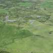
The remains of the township and farmsteads at Leccabuy are evident on visualisations derived from Airborne Laser Scanning data. The remains closely reflect the distribution of buildings depicted on an estate map of 1847 (NRS, RHP571) which shows seven buildings (centred NM 74724 09760) annotated ‘South Leckabuy’, as well as a smaller cluster of two buildings and three huts (centred to the N at NM 74745 09849) annotated ‘Mid Leckabuy’.
An 18th century estate map (NRS, RHP975) indicates that the two farmsteads occupied the site of the township of Leckabuy, one of Luing’s long-standing settlements (Braithwaite 2021, 126-8).
Visited by HES Archaeological Survey (George Geddes and Darroch Bratt), 31 March and 12 April 2022
ACFA Nos. 279-306

