Broad Haven, Mains Of Portlethen
Fort (Later Prehistoric)(Possible), Military Installation (19th Century) - (20th Century)
Site Name Broad Haven, Mains Of Portlethen
Classification Fort (Later Prehistoric)(Possible), Military Installation (19th Century) - (20th Century)
Alternative Name(s) Burn Of Findon
Canmore ID 37203
Site Number NO99NW 25
NGR NO 93632 96613
Datum OSGB36 - NGR
Permalink http://canmore.org.uk/site/37203
- Council Aberdeenshire
- Parish Banchory-devenick
- Former Region Grampian
- Former District Kincardine And Deeside
- Former County Kincardineshire
NO99NW 25 9363 9662.
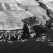
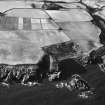
A coastal promontory between Broad Haven and Peel Slough, about 630m ESE of Mains of Portlethen farmhouse, is cut off by a possible ditch 9m broad and 3m deep. The interior measures about 45m from E to W by 17m transversely and is enclosed at the E end by a low bank 1.8m thick and 0.8m high. Midway along the interior a bank 7m thick and 0.8m high cuts across the promontory and turns W along the S side it is uncertain if this is an original feature of the earthwork or merely upcast from a recent military emplacement which has been constructed immediately behind the ditch.
RCAHMS 1984, visited March 1984.
Visible on air photographs AAS/93/15/G30/4-5. Copies held by Grampian Regional Council.
Information from M Greig, Grampian Regional Council, March 1994.
Burn of Findon, earthworks. Air photograph: AAS/97/07/CT.
NMRS, MS/712/29.
Field Visit (March 1984)
NO99NW 25 9363 9662.
A coastal promontory between Broad Haven and Peel Slough, about 630m ESE of Mains of Portlethen farmhouse, is cut off by a possible ditch 9m broad and 3m deep. The interior measures about 45m from E to W by 17m transversely and is enclosed at the E end by a low bank 1.8m thick and 0.8m high. Midway along the interior a bank 7m thick and 0.8m high cuts across the promontory and turns W along the S side it is uncertain if this is an original feature of the earthwork or merely upcast from a recent military emplacement which has been constructed immediately behind the ditch.
RCAHMS 1984, visited March 1984.
Note (10 June 2015 - 31 May 2016)
What may be the remains of a fort are situated on a coastal promontory on the cliffs forming the S side of Broad Haven. The defences comprise a possible ditch some 9m in breadth by 3m in depth cut across the narrowest part of the neck on the W to enclose an area measuring 45m from E to W by 17m transversely (0.07ha). According to the Scheduling document there is possibly an external bank on the W, though this was not observed by RCAHMS investigators in 1984, but any evidence that might be visible of an internal rampart is confused by a military emplacement constructed in a deep trench immediately behind the ditch. Lined with brick and stonework, with a concrete floor and spanned by at least one concrete slab, this was designed to protect the personnel operating the butts for a rifle range firing out to sea from marks between 300 and 600 yards to the W (Kincardineshire 1903, sheet 11.3). The presence of the butts here, apparently reconstructed from an earlier target shown on the first edition of the 1st edition map (Kincardineshire 1868, sheet 8.6) raises the possibility that, rather than a prehistoric fort, all the works along this promontory are in fact connected with the riffle range, including the bank 7m thick by 1.5m that cuts across the middle of the interior to turn W along the S margin, which is also shown in 1903 and was perhaps to stop the overs. The purpose of a bank 1.8m thick by 0.8m high extending along the N margin of the promontory and round the E end is unknown.
Information from An Atlas of Hillforts of Great Britain and Ireland – 31 May 2016. Atlas of Hillforts SC3113


