Following the launch of trove.scot in February 2025 we are now planning the retiral of some of our webservices. Canmore will be switched off on 24th June 2025. Information about the closure can be found on the HES website: Retiral of HES web services | Historic Environment Scotland
Aquhorthies
Recumbent Stone Circle (Neolithic) - (Bronze Age)
Site Name Aquhorthies
Classification Recumbent Stone Circle (Neolithic) - (Bronze Age)
Alternative Name(s) Aquhorties North; Aquhorties Manor; Hillhead Of Aquhorthies
Canmore ID 37186
Site Number NO99NW 1
NGR NO 9018 9634
Datum OSGB36 - NGR
Permalink http://canmore.org.uk/site/37186
- Council Aberdeenshire
- Parish Banchory-devenick
- Former Region Grampian
- Former District Kincardine And Deeside
- Former County Kincardineshire
Field Visit (October 1983)
NO99NW 1 9018 9634.
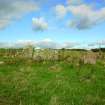
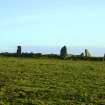
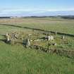
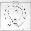
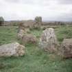
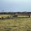
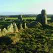
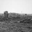
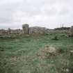
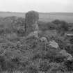
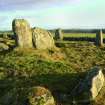
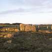
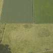
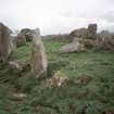
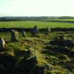
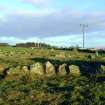
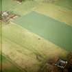
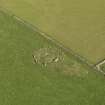
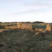
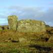
This well-preserved recumbent stone-circle and ring-cairn lies on a low knoll 200m NNE of Aquhorthies farmhouse. The ring-cairn measures about 15.4m in diameter over an almost complete kerb, which ranges from 0.7m in height on the SW and SE to 0.3m on the N, with an exceptionally large boulder 1m high on the ESE. The inner kerb is about 3.2m in diameter, but only five kerbstones, all of them close-fitting rectangular slabs up to 0.7m high, remain in situ. The recumbent (2.8m by 0.8m and 1.3m high) lies on the S between the ring-cairn and the surrounding circle; only the W flanker survives (0.8m by 0.6m at the base and 1.7m in height) and it is linked to the ring-cairn by a kerbstone 1.8m long (Coles' plan of 1900, which is highly inaccurate, shows a similar kerbstone adjacent to the missing E flanker). In front of the recumbent there is a trapezoidal forecourt-like area delineated by a few facing-stones which extend outwards from the flankers towards the neighbouring stones of the surrounding circle (the W of which has fallen). The stone circle measures about 23.7m from NNW to SSE by 22m transversely with twelve stones and a possible stump still in position; the original arrangement appears to have comprised ten large stones (two now missing) with smaller pillars set between them; the latter now only surviving on the N and E.
Apart from the two stones at the mouth of the forecourt, the large stones are graded in height, with the tallest (2.4m high) on the SW and the shortest (1.1m high) on the N; the pillars are also graded in height with the shortest (0.9m high) on the N. A series of boulders set between the uprights may be no more than the facing-stones of an old field-bank which encloses the knoll on which the circle stands. In the late 18th century a cist (0.9m in length by 0.45m in breadth) may have been found on the E side between the ring-cairn and the surrounding circle, and in 1858 excavation in the interior revealed 'charcoal, half-calcined bones, black unctuous earth, and small fragments of a vase'.
RCAHMS 1984
(Statistical Account (OSA) 1792; Name Book 1865; A Thomson 1865; R A Smith 1880; F R Coles 1900; A Thom, A S Thom and A Burl 1980)
Field Visit (29 April 2003)
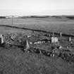
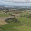
Aquhorthies is not only one of the most impressive recumbent stone circles, but also one of the most complex, preserving a range of visible features that are rarely seen so clearly elsewhere, and indeed some that are otherwise unknown. It stands on a low rise tilted gently down to the E within a field 170m N of Aquhorthies steading. Measuring a maximum of 25m from N to S by 23.5m transversely, in its final form the circle comprised at least eighteen stones set out along the leading edge of a platform encircling a well-defined ring-cairn; of that complement, only fourteen remain, and two of these are reduced to stumps (8a & A). The recumbent setting on the SSE is unusual for the forecourt in front of it, which is framed by two orthostats (A & B) set forward from the projected circumference of the circle, the western of them being one of the stumps.
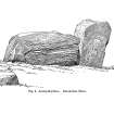
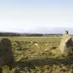
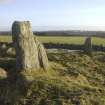
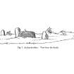
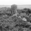
The recumbent block measures 2.75m in length by almost 1.4m in height and its summit is slightly domed, rising to its highest point a little W of centre. The E flanker is missing, but its neighbour on the W is a slender, top-heavy pillar some 1.55m in height, which stands back from the leading face of the recumbent and is turned slightly as if to trace the arc of the circle. At first sight the spacing and heights of the rest of the orthostats appear irregular and uneven, but detailed examination suggests that they represent two incomplete, interdigitated rings, each series of stones distinguishable by their relative sizes; the two framing the forecourt do not belong in either series and can be argued on other grounds to be additions to any original design. The major series, originally comprising eight stones, is now represented by six, namely 4, 6–7 and 9–11. These are graded to reduce in height and spacing from S to N, with the tallest almost 2.4m in height on the SW (11), and the shortest only 1.1m in height on the NNE (7); orthostat 9 on the NW bears a possible cupmark 0.6m above the ground on its external face. The minor series had at least seven stones if the survivors on the E were matched symmetrically on the W, and possibly as many as nine if the gaps between the major series and the flankers were filled. It is now made up of only five (4a–8a), one of which is a stump (8a). By and large these are comparatively slender pillars in comparison to the stones of the major series; they are not so tall either, and yet they too are graded in height, stepping down around the NE quadrant from about 1.5m on the E (4a) to 0.6m on the N (7a). The two slabs framing the mouth of the forecourt (A & B) conform to the spacing of the major series, but if the height of the eastern (B), a little more than 1.3m, was repeated on the W, they were not integrated conventionally into its grading. Their positions set forward from the circle emphasise the depth of the forecourt, and the breadth of the platform of cairn material to either side also expands to 5m and 6m on E and W respectively; a line of four small kerbstones that can be seen flush with its surface to the W of the forecourt (D), suggests that the expansion around the S side of the monument is probably an addition to an original platform only 3m broad. The displaced and set stones intermittently visible along the leading edge of the expanded platform and the forecourt, and also between the orthostats along the eastern margin of the circle, show that the platform at Aquhorthies was more formally defined than most of those recorded elsewhere.
The ring-cairn standing within the circle is roughly circular and measures 15.5m in diameter over a near continuous kerb of slabs and boulders. These are not consistently graded in size, but the smaller ones are on the N, while the largest is on the S and forges the link with the W flanker of the recumbent setting; as at nearby Auchlee (No. 5), the kerb on the ESE includes a stone (C) that at 0.85m is much higher than any of its neighbours. The body of the ring-cairn is heavily robbed, so much so that most of the kerbstones stand proud of its surface, but the cairn material around the shallow depression defining the central court is about 0.5m deep; five slabs belonging to the kerb of the court remain in place, three on the N and two on the E. A sub-rectangular hollow on the NE of the court (D) and a slab lying beside it have been identified as the remains of the containing an urn found here in the late 18th century, but the first description of the discovery of this burial placed it on the E side of the platform encircling the ring-cairn.
Visited by RCAHMS (ATW, KHJM) 29 April 2003
Measured Survey (29 April 2003)
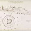
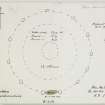
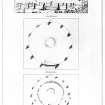
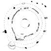
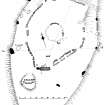
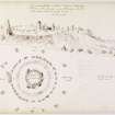
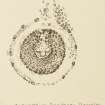
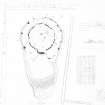
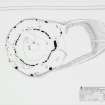
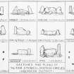
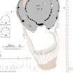
RCAHMS surveyed Aquhorthies recumbent stone circle on 29 April 2003, editing a previous RCAHMS plan of 1983. Sections and an elevation of the principal stones were also produced. The survey drawing was redrawn in ink and used as the basis for an illustration produced in vector graphics software for publication at a scale of 1:250 (Welfare 2011, 281).


