Pricing Change
New pricing for orders of material from this site will come into place shortly. Charges for supply of digital images, digitisation on demand, prints and licensing will be altered.
Cambusmore Estate
Archaeological Landscape (Prehistoric) - (Post Medieval), Broch(S) (Period Unassigned), Chambered Cairn(S) (Period Unassigned), Dun(S) (Period Unassigned), Enclosure(S) (Period Unassigned), Farmstead(S) (Period Unknown), Field System(S) (Period Unassigned), Hut Circle(S) (Prehistoric), Township(S) (Medieval) - (Post Medieval)
Site Name Cambusmore Estate
Classification Archaeological Landscape (Prehistoric) - (Post Medieval), Broch(S) (Period Unassigned), Chambered Cairn(S) (Period Unassigned), Dun(S) (Period Unassigned), Enclosure(S) (Period Unassigned), Farmstead(S) (Period Unknown), Field System(S) (Period Unassigned), Hut Circle(S) (Prehistoric), Township(S) (Medieval) - (Post Medieval)
Canmore ID 367946
Site Number NH79NW 51
NGR NH 7129 9845
Datum OSGB36 - NGR
Permalink http://canmore.org.uk/site/367946
- Council Highland
- Parish Dornoch
- Former Region Highland
- Former District Sutherland
- Former County Sutherland
Field Walking (September 2018 - November 2018)
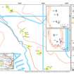
NH 7129 9845 (centred on) A walkover survey was carried out, between September and November 2018, in advance of a woodland management and planting scheme. A desk-based assessment identified 112 heritage assets within the estate boundary, which include prehistoric hut circles and field systems, chambered cairns, brochs and duns, and medieval or post-medieval townships, farmsteads and enclosures. The walkover survey targeted areas of the Estate being considered for woodland planting proposals, by visiting the known sites and identifying 106 previously unrecorded sites in various states of preservation. A summary of the results by area is written below, but full details and maps of all sites can be found in the survey report.
At Garvary, at the W edge of the estate, while a small post-medieval settlement had been known from historic mapping, many degraded turf buildings or shielings were recorded and believed to pre-date the sites on the historical maps. On the slopes above Loch Buidhe, further shieling structures and rough stone-built enclosures were identified (Canmore ID: 13920); while on the higher ground above the loch, there were also several prehistoric hut circles, many in a poor state of preservation.
To the E of Loch Buidhe, along Srath Carnaig (Canmore ID: 14826), to Brae Cottage, survey recorded the location and condition of prehistoric hut circles with associated field systems. The sites, which were mostly degraded, tended to be located on the higher ground. Medieval or post-medieval settlements were present at An Sgoltadh and Brae Cottage, containing a mixture of farmstead buildings, kiln barns, enclosures and boundary dykes. Two scheduled monuments comprising a broch and two hut circles were also surveyed in this area.
The valley of Strath Tollaidh (Canmore 5492, 5493) revealed a similar picture of prehistoric hut circles and field systems located on the higher slopes with medieval or post-medieval structures on raised ground closer to the burn. Several previously unknown clusters of turf structures, probably forming shieling settlements, were also recorded here.
Post-medieval settlements are known from historic mapping between Dalnamain and Garskelly, although some townships, such as Dalnamain and Achtaduaig were located outside of the woodland planting areas and were not surveyed. Settlement at Garskelly was recorded along with several new medieval or later structures nearby identified along the stream courses. The site of a possible dun at Torri Falaig was also surveyed (Canmore ID: 14804).
In the area around Loch Ruagaidh several prehistoric hut circle settlements and field systems were recorded, including the scheduled monument of Carn Liath (SM 900060; Canmore ID: 6546). Hut circles here were well preserved with double-faced stone walls and the field systems consisted of numerous small clearance cairns. Of the two chambered cairns at Carn Liath, only one was accessible, the other being obscured by recent tree windfall. Sitting just above the Abhainn an t-Srath Charnaig, another scheduled monument, a kerb cairn with a nearby hut circle, was surveyed. Further prehistoric and post-medieval sites are present at Torboll, but many of these are outside of the survey area.
In the southern and eastern parts of the Estate, post-medieval settlement was previously known at Leathad na Cloiche (Canmore ID: 14812), Ben Tarvie (Canmore ID: 268887), Allt Tigh Neill and Leathad na Seamraig (Canmore ID: 91316,91317,91318). Extensive settlement remains were recorded here, revealing many more structures than listed on previous records or shown on the historic mapping. Most structures were formed of rectangular stone building foundations with attached kale-yards and enclosures. Interestingly, there were at least six kiln-barns recorded at Leathad na Cloiche, and there were others found at smaller settlements. Dispersed amongst the post-medieval settlement, the degraded remains of prehistoric hut circles and clearance cairns were also present at Leathad na Cloiche.
A similar mixture of prehistoric and post-medieval settlement was also found at Achinael, the site of a scheduled monument comprising a prehistoric hut circle settlement alongside medieval turf structures and later post-medieval stone structures. Some of the hut circles in this landscape had been later re-structured and used as enclosures.
Further prehistoric settlement surveyed is present along the slopes of Creag an Amalaidh in the form of the scheduled chambered cairn (SM 1772, 1851; Canmore ID: 14782, 198460) and well-preserved stone-walled hut circles (Canmore ID: 14766, 14770). Another chambered cairn with at least two associated hut circles and a field system is also present on the slopes of Cnoc Odhar (Canmore ID: 14764).
It is clear from the survey that there is a rich archaeological landscape at Cambusmore Estate which spans from prehistoric to post-medieval. While many of the sites are very degraded, others show remarkably good levels of preservation. The disparity between historic mapping and the recorded sites may have been the result of a widespread abandonment of the area in the late 18th/early 19th century.
Archive: NRHE
Funder: KR Greenland Farming
Lindsey Stirling - AOC Archaeology
(Source: DES Vol 20)


