
Following the launch of trove.scot in February 2025 we are now planning the retiral of some of our webservices. Canmore will be switched off on 24th June 2025. Information about the closure can be found on the HES website: Retiral of HES web services | Historic Environment Scotland
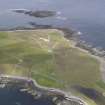
North Ronaldsay, Dennis Ness


Cairn (Prehistoric), Cist (Prehistoric), Dyke(S) (Prehistoric)
Site Name North Ronaldsay, Dennis Ness
Classification Cairn (Prehistoric), Cist (Prehistoric), Dyke(S) (Prehistoric)
Alternative Name(s) Dennis Head
Canmore ID 3652
Site Number HY75NE 6
NGR HY 78679 55794
Datum OSGB36 - NGR
Permalink http://canmore.org.uk/site/3652


- Council Orkney Islands
- Parish Cross And Burness
- Former Region Orkney Islands Area
- Former District Orkney
- Former County Orkney
HY75NE 6 7868 5580
Overlaid by a modern wall at HY 7868 5580 is a denuded cairn, measuring c8.0m in diameter and 0.3m high. Exposed in its centre is a cist, excavated by Mr J D MacKay, Central Schoolhouse, Sanday, during the last war and found to contain 'ashes' only. It is oriented NNE-SSW and measures 1.8m in length and 0.5m in depth but its width cannot be determined. The W side is formed of two slabs on edge, and the ends apparently by dry-stone walling.
Extending from the cairn in a SSE direction for about 54.0m, and to the N for 14.0m, is a denuded turf- covered wall. Some 100.0m to the S is a similar wall with no associated mounds, which is overlaid by a modern rectangular enclosure.
The construction of the cist, in combing dry-stone walling with upright slabs, and the association of the cairn with a wall, is similar to that at Elsness, Sanday (HY63NE 5)
Surveyed at 1/2500
Visited by OS (NKB), 20 July 1970.
Field Visit (August 1979)
As described. Turf covered dykes are probably part of same
complex as field system by lighthouse.
NoSAS index NRO 21, J Hedges Sept 1977, cf OR 214.
As described. There is no real evidence that the dyke
overrides and is later than cairn, and this looks very much like
a vestige of a dykes-and-burial-cairns complex comparable with
those on the Sanday nesses, especially Tafts Ness. This dyke
does extend the full 100m to the other dyke mentioned by OS,
which it joins forming a T-junction. Some massive basal
orthostats of Goth dykes survive, and it is possible that the
large slabs at the T-junction are the remains of the central
structure of another cairn.
Information from Orkney SMR (RGL) Aug 79.
Note (1980)
Dennis Ness, North Ronaldsay HY 7868 5580 HY75NE 6
Cairn containing cist excavated during the Second World War. A vestigial dyke runs SSE from it for 100m to a T-junction with another dyke, which is partly overlain by the modern pund; several large orthostats at the junction are probably remains of another cairn.
RCAHMS 1980
(OR 213)
Field Visit (1999)
A cairn containing a cist was excavated during WWII. It was oriented NNE-SSW, measuring 1.8m long and 0.5m deep; the width could not be determined because only one side survived. This was formed from two edge-set slabs, while the end walls were made from coursed masonry. It is said to have contained 'ashes'. Remnants of a drystone dyke ran from the SSE side of the cairn for over 100m and then formed a T-junction with a second ruinous wall. Only a few scattered earthfast wall stones now remain. The cairn survives as an amorphous mound, some 15m in diameter and 1m high. It lies 4m from the coast edge. Ref.: RCAHMS (1980), #17, 18.
Moore & Wilson 1999.
Coastal Zone Assessment Survey, 1999

