
Pricing Change
New pricing for orders of material from this site will come into place shortly. Charges for supply of digital images, digitisation on demand, prints and licensing will be altered.
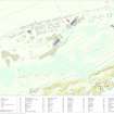
North Sutor, Coast Battery


Weapons Pit (Second World War)
Site Name North Sutor, Coast Battery
Classification Weapons Pit (Second World War)
Alternative Name(s) Cromarty Defences; Fort North Sutor, Site No. 1
Canmore ID 363522
Site Number NH86NW 9.56
NGR NH 82056 69021
Datum OSGB36 - NGR
Permalink http://canmore.org.uk/site/363522


- Council Highland
- Parish Nigg (Ross And Cromarty)
- Former Region Highland
- Former District Ross And Cromarty
- Former County Ross And Cromarty
Field Visit (26 March 2019)
This grass-grown weapons pit, which is situated 6.8m ENE of the point at the edge of a shelter belt where the WWII security fence (NH86NW 9.51) has been taken down, formed part of the defences of the battery introduced by the Army during that period. It is roughly rectangular on plan, measuring 3.6m from WSW to ENE by 1.6m transversely and 0.4m in depth, but there is no trace of a low protective bank as seen at comparable sites (e.g. NH86NW 9.50 and 52). A narrow gully running beneath the fence allows access from within the battery, while a stray length of speaking tube partly overlies the pit N of the fence.
Visited by HES, Survey and Recording (ATW, AKK), 26 March 2019.

