Pricing Change
New pricing for orders of material from this site will come into place shortly. Charges for supply of digital images, digitisation on demand, prints and licensing will be altered.
Upper Shampher
Cairn (Period Unassigned), Field System (Period Unassigned)
Site Name Upper Shampher
Classification Cairn (Period Unassigned), Field System (Period Unassigned)
Canmore ID 36209
Site Number NO69SE 7
NGR NO 6695 9370
NGR Description NO 6695 9370 and NO 670 936
Datum OSGB36 - NGR
Permalink http://canmore.org.uk/site/36209
- Council Aberdeenshire
- Parish Strachan
- Former Region Grampian
- Former District Kincardine And Deeside
- Former County Kincardineshire
NO69SE 7 6695 9370 and 670 936.
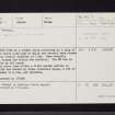
At NO 6695 9370 is a robbed cairn surviving as a ring of material about 0.5m high in which are several kerb stones giving an overall diameter of 7.2m. Some recently cleared stones lie within the interior. The NW arc is dipped by an old track.
The cairn lies within a field system centred at NO 670 936 and marked by stone clearance heaps, a few of them robbed to a rim, and lynchets. Surveyed at 1/2500
Visited by OS (I S S) 11 August 1972.
No change to previous field report.
Surveyed at 1:10,000.
Visited by OS (N K B) 28 April 1978.


