Pricing Change
New pricing for orders of material from this site will come into place shortly. Charges for supply of digital images, digitisation on demand, prints and licensing will be altered.
North Berwick Law
Rig And Furrow (Post Medieval)
Site Name North Berwick Law
Classification Rig And Furrow (Post Medieval)
Canmore ID 360967
Site Number NT58SE 170
NGR NT 5571 8407
Datum OSGB36 - NGR
Permalink http://canmore.org.uk/site/360967
- Council East Lothian
- Parish North Berwick
- Former Region Lothian
- Former District East Lothian
- Former County East Lothian
Field Visit (25 October 2018)
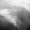
Fugitive traces of rig and furrow cultivation on the SE flank of North Berwick Law are visible on oblique aerial photographs taken in 1983 (RCAHMSAP) and on an image-based model (HES 2018). Evidently the remains of a once much larger area of cultivation that extended into what is now a large arable field to the E and SE, the rigs occupy a comparatively small triangular area measuring about 120m from NE to SW by 40m transversely. The individual rigs are aligned NNW and SSE, and measure from 2.5m to 3.5m across. On the NW the rigs may have been contained within a bank (10.6) which has been breached by cultivation in its latest phase. Later paths cut across the area from NE to SW.
Information from HES Survey and Recording (GFG, DC) 25 October 2018
(NBL26)


