Pricing Change
New pricing for orders of material from this site will come into place shortly. Charges for supply of digital images, digitisation on demand, prints and licensing will be altered.
North Berwick Law
Wall (Period Unknown)
Site Name North Berwick Law
Classification Wall (Period Unknown)
Canmore ID 359831
Site Number NT58SE 32.01
NGR NT 5546 8412
Datum OSGB36 - NGR
Permalink http://canmore.org.uk/site/359831
- Council East Lothian
- Parish North Berwick
- Former Region Lothian
- Former District East Lothian
- Former County East Lothian
Field Visit (22 February 2018)
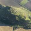
A relatively level terrace on the SW flank of North Berwick Law is partly enclosed (on the SW, W and N) by a wall at least 2m thick that has been reduced to little more than a grass-grown stony scarp in which three outer facing-stones are visible on the N. The terrace measures 46m from N to S by at least 40m transversely, but there is no evidence of a wall, bank or other form of enclosure on the SE and E, and on the N, instead of extending SE as might be expected of an enclosure wall, it turns to the NNE for about 12m before apparently petering out. Previously interpreted as an enclosure and part of the fort proper (Feachem 1963), the function and date of the feature remain unknown.
Visited by HES Survey and Recording (GFG) 22 February 2018.
(NBL3)


