|
Photographs and Off-line Digital Images |
AN 4418 |
John Dewar |
Oblique aerial view of Pert Old Parish Church and graveyard and Upper North Water Bridge with the new bridge under construction. |
9/1970 |
Item Level |
|
|
Photographs and Off-line Digital Images |
AN 4419 |
John Dewar |
Oblique aerial view of Pert Old Parish Church and graveyard and Upper North Water Bridge with the new bridge under construction. |
9/1970 |
Item Level |
|
|
Photographs and Off-line Digital Images |
AN 4420 |
John Dewar |
Oblique aerial view of Pert Old Parish Church and Upper North Water Bridge with the new bridge under construction. |
9/1970 |
Item Level |
|
|
Photographs and Off-line Digital Images |
AN 4533 |
John Dewar |
Oblique aerial view of Pert Old Parish Church and Upper North Water Bridge with the new bridge under construction. |
1970 |
Item Level |
|
|
Photographs and Off-line Digital Images |
KC 1449 |
List C Survey |
General view. |
1975 |
Item Level |
|
|
Photographs and Off-line Digital Images |
KC 1935 PO |
Papers of Professor John R Hume, economic and industrial historian, Glasgow, Scotland |
View from South-East, showing ribbed vaulting. |
1974 |
Item Level |
|
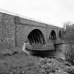 |
On-line Digital Images |
SC 428924 |
Papers of Professor John R Hume, economic and industrial historian, Glasgow, Scotland |
Upper North Water Bridge
View along side of bridge |
1974 |
Item Level |
|
|
Manuscripts |
MS 749/4410 |
Papers of Professor John R Hume, economic and industrial historian, Glasgow, Scotland |
John R Hume Industrial/CBA cards
Filed under Angus, Logie Pert parish. Contact print attached (Hume photo index number H74/111/11). (see NMRS MS/749 entry for Collection description) |
11/5/1974 |
Item Level |
|
|
Print Room |
G 81734 NC |
|
Newscutting showing general view of bridge.
Titled: 'On the North Esk. North Water Bridge, linking Kincardinehsire with Angus'. |
26/4/1947 |
Item Level |
|
|
Photographs and Off-line Digital Images |
AN 695 |
Stewart H Cruden |
General view. |
1947 |
Item Level |
|
|
Photographs and Off-line Digital Images |
AN 693 |
Stewart H Cruden |
General view. |
1947 |
Item Level |
|
|
Photographs and Off-line Digital Images |
AN 694 |
Stewart H Cruden |
General view. |
1947 |
Item Level |
|
|
Photographs and Off-line Digital Images |
G 92829 CS |
Records of Historic Scotland, Edinburgh, Scotland |
General view from W. |
15/8/1991 |
Item Level |
|
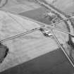 |
On-line Digital Images |
SC 1015095 |
Records of Aberdeen Aerial Surveys, Aberdeen, Scotland |
Oblique aerial view centred on North Water Bridge and the A90, looking to the SE. |
8/8/1984 |
Item Level |
|
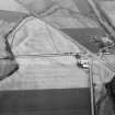 |
On-line Digital Images |
SC 1015096 |
Records of Aberdeen Aerial Surveys, Aberdeen, Scotland |
Oblique aerial view centred on North Water Bridge and the A90, looking to the ESE. |
8/8/1984 |
Item Level |
|
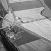 |
On-line Digital Images |
SC 1015097 |
Records of Aberdeen Aerial Surveys, Aberdeen, Scotland |
Oblique aerial view centred on North Water Bridge and the A90, looking to the WNW. |
8/8/1984 |
Item Level |
|
 |
On-line Digital Images |
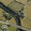
DP 020556 |
RCAHMS Aerial Photography Digital |
Oblique aerial view centred on the road bridges and tollhouse, taken from the WNW. |
8/9/2006 |
Item Level |
|
 |
On-line Digital Images |
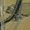
DP 020557 |
RCAHMS Aerial Photography Digital |
Oblique aerial view centred on the road bridges and tollhouse, taken from the SW. |
8/9/2006 |
Item Level |
|
 |
On-line Digital Images |
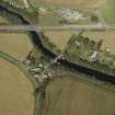
DP 020558 |
RCAHMS Aerial Photography Digital |
Oblique aerial view centred on the road bridges and tollhouse, taken from the SE. |
8/9/2006 |
Item Level |
|
 |
On-line Digital Images |
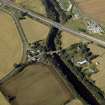
DP 020559 |
RCAHMS Aerial Photography Digital |
Oblique aerial view centred on the road bridges and tollhouse with the church and burial ground adjacent, taken from the E. |
8/9/2006 |
Item Level |
|
 |
On-line Digital Images |
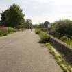
DP 061484 |
Records of the Royal Commission on the Ancient and Historical Monuments of Scotland (RCAHMS), Edinbu |
View of deck from N |
2/7/2009 |
Item Level |
|
 |
On-line Digital Images |
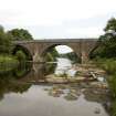
DP 061485 |
Records of the Royal Commission on the Ancient and Historical Monuments of Scotland (RCAHMS), Edinbu |
View from W |
2/7/2009 |
Item Level |
|
 |
On-line Digital Images |
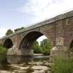
DP 061486 |
Records of the Royal Commission on the Ancient and Historical Monuments of Scotland (RCAHMS), Edinbu |
View from SW |
2/7/2009 |
Item Level |
|
 |
On-line Digital Images |
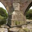
DP 061487 |
Records of the Royal Commission on the Ancient and Historical Monuments of Scotland (RCAHMS), Edinbu |
Detail of cutwater |
2/7/2009 |
Item Level |
|


