
An Caladh Croft


Dyke(S) (Iron Age)
Site Name An Caladh Croft
Classification Dyke(S) (Iron Age)
Canmore ID 358280
Site Number NH56SW 59
NGR NH 51956 62228
Datum OSGB36 - NGR
Permalink http://canmore.org.uk/site/358280


- Council Highland
- Parish Fodderty
- Former Region Highland
- Former District Ross And Cromarty
- Former County Ross And Cromarty
Excavation (20 September 2015 - 14 May 2017)
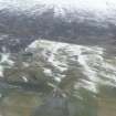
NH 51956 62228 Fan-shaped long linear dykes are visible in moorland near the Heights of Docharty near Dingwall. It is an area of prehistoric activity, but maps do not show much settlement before 1800. The Inverness Young Archaeologists Club investigated these dykes between the 20 September
2015 and 14 May 2017, with the 2017 season supported by a grant from the HLF.
The 2015 season put two trenches across the biggest dyke, and discovered that the builders had put down a layer of clay, and then layers of turf. A layer of burning was just above the clay. The 2017 season put a long trench across what was originally thought to be three dykes. It turned out that the E dyke did not have the clay base, although there was some
burning. The other two dykes appear to have been a ditch with banks created on both sides.
Suitable material for dating was hard to obtain from the banks at An Caladh Croft (Adam’s Croft). Despite processing over 80kg of samples, only a few pieces of charcoal were recovered. Of these only one was deemed suitable for dating, and this returned a date of 2362 +/- 30 BP, 385 cal BC (SUERC-75687 – GU45772). The dated charcoal was obtained from the lower parts of turf bank 1, above the clay. It showed signs of abrasion and wear suggesting that it may have moved around, so this date is very much limited to terminus post quem or the earliest possible date for the bank. However, a date range in the Iron Age is still useful as it shows the banks are not likely to be Bronze Age structures, as previously thought possible, and are therefore unlikely to be connected to the nearby roundhouse/hut circle settlements.
Report: Highland HER and NRHE (intended)
Funder: Heritage Lottery Fund
Website: http://www.spanglefish.com/invernessyac/
Susan Kruse and Lachlan McKeggie – Inverness YAC
(Source: DES, Volume 18)

