
Pricing Change
New pricing for orders of material from this site will come into place shortly. Charges for supply of digital images, digitisation on demand, prints and licensing will be altered.
Upcoming Maintenance
Please be advised that this website will undergo scheduled maintenance on the following dates:
Thursday, 9 January: 11:00 AM - 3:00 PM
Thursday, 23 January: 11:00 AM - 3:00 PM
Thursday, 30 January: 11:00 AM - 3:00 PM
During these times, some functionality such as image purchasing may be temporarily unavailable. We apologise for any inconvenience this may cause.
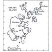
Sanday, Tofts Ness


Roundhouse (Prehistoric), Settlement (Iron Age)
Site Name Sanday, Tofts Ness
Classification Roundhouse (Prehistoric), Settlement (Iron Age)
Canmore ID 3574
Site Number HY74NE 3
NGR HY 760 470
Datum OSGB36 - NGR
Permalink http://canmore.org.uk/site/3574


- Council Orkney Islands
- Parish Lady
- Former Region Orkney Islands Area
- Former District Orkney
- Former County Orkney
HY74NE 3 760 470
See also HY74NE 1 and HY74NE 5.
In 1985 excavation commenced upon a settlement mound, which forms part of a well preserved archaeological landscape on the peninsula of Tofts Ness, Sanday (for which, see HY74NE 1).
Geophysical survey has suggested that the mound extends beyond its apparent physical edges, to the S and E. Two trenches were excavated to indicate the extent and nature of the archaeological material which is threatened by mole ploughing on the southern and eastern flanks of the mound.
Excavation revealed that the mound's edges are buried by wind blown sand reducing the visible physical extent of the site. Rich midden layers were encountered containing well preserved animal bone and mollusc remains. Evidence was also found of a structure some 4m in diameter, with a S facing entrance and flagged floor.
Pottery recovered contains a number of incised decorated sherds suggesting a Bronze Age context for the site.
S J Dockrill 1985.
Excavation continued in advance of agricultural improvement, and revealed a well preserved round house and annexe surrounded by a buried soil containing evidence of ard cultivation. Dating evidence suggests a late Bronze Age context for this building complex. Trenches transecting the S and E edges of the mound produced evidence of two structures and substantial midden deposits dating to the early bronze age.
S J Dockrill 1986.
Publication Account (1996)
The ancient landscape on the promontory of Tofts Ness is typical of the extensive remains that can survive in marginal areas. Before excavation, there was little indication of the date of this great complex of large mounds up to 30m or more in diameter, low enclosure banks and small cairns in their hundreds, apart from some recent kelp kilns and kelp-drying stances. But selective excavation has identified circular houses and fields of two main periods, one neolithic and early bronze age and the other spanning the late bronze age and early iron age. From the earliest settlement on the promontory onwards, people were growing cereal crops (even using manure as fertiliser) and breeding cattle and sheep, and by the bronze age they were importing steatite from Shetland.
Information from ‘Exploring Scotland’s Heritage: Orkney’, (1996).
Field Visit (1999)
An extensive complex of earthen banks and cairns are located to the east side and tip of Tofts Ness. Within the complex are several larger mounds and groups of smaller mounds which are located in close proximity and which together form chains or enclosures. Previously, it was speculated that the majority of the mounds were likely to be funerary monuments, possibly surrounding larger Maes-Howe type tombs, however, investigations in the 1980's revealed a Bronze Age structural complex, rich midden deposits and buried cultivation soils. The results of this work are awaited and as yet there is very little known for certain about the remains in the wider landscape. Two mounds and two stone concentrations are located on the coast edge and are vulnerable to erosion. Stones protrude from the mounds, possibly indicating the presence of structural remains. The stone concentrations may represent remnant structures which have been damaged by erosion but could alternatively be the ex-situ remains of structures removed from further inland. Ref.: RCAHMS (1946), #474; RCAHMS (1980), #15; Dockrill, SJ (1985) 'Sanday (Lady parish), Tofts Ness. Settlement', DES (1985), 32; Dockrill, SJ (1986) 'Sanday, Tofts Ness. Bronze Age settlement mound', DES (1986), 22-3.
Moore & Wilson 1999.
Coastal Zone Assessment Survey, 1999
Publication Account (2002)
HY74 5 TOFTS NESS ('Toftsness', 'Taft's Ness')
HY/757464
Early Iron Age roundhouse in Lady parish on Sanday. The site was excavated in advance of land improvement from 1985 to 1988 and work was focussed on the roundhouse and on systematically examining the surrounding prehistoric soils. Interim accounts of the latter have been published and some significant inferences made [2, 3]. Fragments of another, earlier roundhouse were found.
There are a variety of other ancient structures in this area, including “earth-houses” [5] and graves. In 1885 J.W.Cursiter showed some finds of Iron Age type "from a broch on Toftsness, Sanday" at the Society of Antiquaries of Scotland [4]. They included several awls (“borers”), presumably of bone, and some grooved pumice sharpeners. A rough stone whorl is in his collection at the Hunterian Museum (B.1914.810). It may be that these finds came from the recently discovered roundhouse .
Sources: 1. OS card HY74 NE 1: 2. Discovery and Excavation in Scotland 1985, 32: 1986, 220-3: 1987, 36: 1988, 29: 3. Dockrill 2002, 156-58 and refs.. 4. Proc Soc Antiq Scot 19 (1884-1985), 139: 5. RCAHMS 1946, 2, 172-3, no. 474.
E W MacKie 2002

