
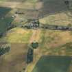
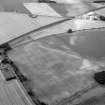
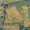
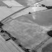
Langleypark


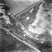
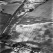
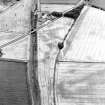
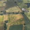
Linear Feature(S) (Period Unknown), Rig And Furrow (Medieval) - (Post Medieval)
Site Name Langleypark
Classification Linear Feature(S) (Period Unknown), Rig And Furrow (Medieval) - (Post Medieval)
Canmore ID 35702
Site Number NO65NE 48
NGR NO 6870 5990
NGR Description Centred on NO 6870 5990
Datum OSGB36 - NGR
Permalink http://canmore.org.uk/site/35702


- Council Angus
- Parish Dun
- Former Region Tayside
- Former District Angus
- Former County Angus

