Pricing Change
New pricing for orders of material from this site will come into place shortly. Charges for supply of digital images, digitisation on demand, prints and licensing will be altered.
Upcoming Maintenance
Please be advised that this website will undergo scheduled maintenance on the following dates:
Thursday, 9 January: 11:00 AM - 3:00 PM
Thursday, 23 January: 11:00 AM - 3:00 PM
Thursday, 30 January: 11:00 AM - 3:00 PM
During these times, some functionality such as image purchasing may be temporarily unavailable. We apologise for any inconvenience this may cause.
Law Quarry
Building(S) (19th Century), Graffiti (Modern), Refuse Disposal Site (Modern), Stone Quarry(S) (Post Medieval)
Site Name Law Quarry
Classification Building(S) (19th Century), Graffiti (Modern), Refuse Disposal Site (Modern), Stone Quarry(S) (Post Medieval)
Alternative Name(s) North Berwick Law
Canmore ID 356479
Site Number NT58SE 136
NGR NT 55477 83917
Datum OSGB36 - NGR
Permalink http://canmore.org.uk/site/356479
- Council East Lothian
- Parish North Berwick
- Former Region Lothian
- Former District East Lothian
- Former County East Lothian
Field Visit (3 May 2018)
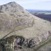
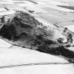
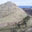
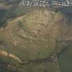
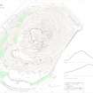
Evidence of stone (trachyte) quarrying is visible around the entire length of the foot of the southern flank of North Berwick Law, a distance of at least 400m from SE to SW. An estate map of 1804 (NRS RHP1726) depicts a quarry here which measured some 180m in length. The eastern end of these workings survives, though now enshrouded in gorse, but the western end has been lost - subsumed within the gradual expansion of the quarry, a process that has been documented by subsequent editions the OS 6-inch map (Haddingtonshire Sheet 2, 1854; Sheet II.SE, 1895; 1906; c.1948). This part of the quarry, which remained open until the middle of the 20th century, measures about 170m from WNW to ESE by 40m in breadth and 15m in depth. However, for a time soon after it was closed the quarry was used as a refuse dump, a consequence being that the present ground surface is probably several meters above the final quarry floor. Nothing is visible of the small roofed building (NT 5547 8389) depicted on the 25-inch map (Haddingtonshire 1894, Sheet II.12), or a larger structure depicted on the 1945 edition immediately to the N.
In recent times the eastern end of the N face of the quarry has been used by rock-climbers, evidenced by the presence of numerous bolts that mark several routes. Also present, again largely towards the eastern end, are several graffiti.
Visited by HES Survey and Recording (GFG) May 2018.
(NBL22)


