
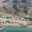
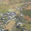
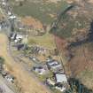
Achtercairn


Boundary Wall (Medieval), Roundhouse (Iron Age)
Site Name Achtercairn
Classification Boundary Wall (Medieval), Roundhouse (Iron Age)
Canmore ID 355348
Site Number NG87NW 56
NGR NG 806 771
Datum OSGB36 - NGR
Permalink http://canmore.org.uk/site/355348


- Council Highland
- Parish Gairloch
- Former Region Highland
- Former District Ross And Cromarty
- Former County Ross And Cromarty
Excavation (2015)
NG 806 771 A privately funded excavation was carried out at Achtercairn to clarify the results of the Wedigs Project regarding the relationship of landscape boundaries and associated round houses. The Achtercairn 4 site was chosen because of the apparent relationship of an orthostatic boundary to the stone roundhouse wall (the boundary appeared to overrun the wall). The excavation demonstrated that the field enclosures were much later than the round house wall. Radiocarbon dates for construction horizons relating to the roundhouse (sealed under the central hearth) and boundary wall returned calibrated dates at 95% probability of 683–638 calBC for the roundhouse and 787–1019calAD for the boundary wall.
The extensive orthostat field enclosures at Achtercairn were therefore laid out some 1500 years after the occupation of the Achtercairn 4 roundhouse and, in all probability, are not related to any of the visible round houses at Achtercairn.
Archive: With sponsors
Sponsors: Anna Welti, Martin Wildgoose and Jeremy Fenton
Anna Welti and Martin Wildgoose
(Source: DES, Volume 16)

