Following the launch of trove.scot in February 2025 we are now planning the retiral of some of our webservices. Canmore will be switched off on 24th June 2025. Information about the closure can be found on the HES website: Retiral of HES web services | Historic Environment Scotland
Colliston Castle
Tower House (Medieval)
Site Name Colliston Castle
Classification Tower House (Medieval)
Alternative Name(s) Colliston House
Canmore ID 35474
Site Number NO64NW 4
NGR NO 61252 46410
Datum OSGB36 - NGR
Permalink http://canmore.org.uk/site/35474
- Council Angus
- Parish Arbroath And St Vigeans
- Former Region Tayside
- Former District Angus
- Former County Angus
NO64NW 4.00 61252 46410
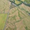
NO64NW 4.01 NO 61188 46519 Stable block
NO64NW 4.02 Centred NO 61379 46389 Walled Garden
(NO 6125 4640) Colliston Castle (NAT)
Tower (NR)
OS 6" map (1970)
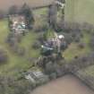
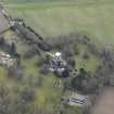
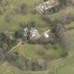
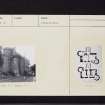
Colliston Castle is of the Z-plan, built in 1553 with round towers at the angles, both of which were originally brought out to the square at the top by means of corbelling, but only one retains this feature.
The oblong block measures c. 45' x 24'6". The entrance was in the re-entrant angle of the tower, and is flanked by two shot-holes, but in 1620-1 the entrance doorway was built up and a new entrance was made in the centre of the house. The first floor windows were enlarged, and the walls appear to be heightened, and a new roof put on. The date of the castle, 1553, is carved on the stair turret over the doorway. The new doorway bears the date 1621. The castle was occuped by the Guthries until 1670.
D MacGibbon and T Ross 1891
The SW portion of Colliston Castle is of Z-plan and is mainly as described except that the original entrance in the S re-entrant angle is again serving as the principal entrance, and the 1621 entrance is blocked up and a window inserted in its place. All the buildings to the N and E are modern, bearing dates of 1721, 1803, 1893 etc, while the date stones 1583 (not 1553 as stated) and 1621 remain where described. The altered NW tower is surmounted by a plain circular parapet, the walls are harled, and most of the window openings are modern. The building is occupied.
Visited by OS (JLD) 12 June 1958
NMRS REFERENCE
Architects: Hay Henderson & Tarbolton - alterations and resoration 1895.
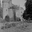
Photographic Survey (22 July 1957)
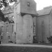
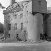
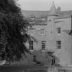
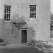
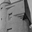
Photographs of the exterior of Colliston Castle, Angus, by the Ministry of Works/Scottish National Buildings Record in July 1957.


