Accessibility

Font Size

100% 150% 200%

Background Colour

Default Contrast
Close Reset

Douglasmuir

Ring Ditch House(S) (Prehistoric)

Site Name Douglasmuir

Classification Ring Ditch House(S) (Prehistoric)

Canmore ID 35472

Site Number NO64NW 38

NGR NO 6170 4809

NGR Description Centred NO 6170 4809

Datum OSGB36 - NGR

C14 Radiocarbon Dating

Permalink http://canmore.org.uk/site/35472

Ordnance Survey licence number AC0000807262. All rights reserved.
Canmore Disclaimer. © Bluesky International Limited 2025. Public Sector Viewing Terms

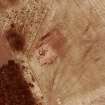
Toggle Aerial | View on large map

Digital Images

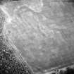
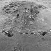
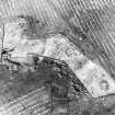
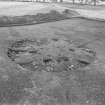
Oblique aerial view.
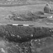
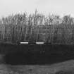
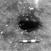
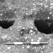
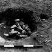
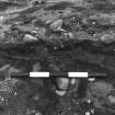
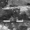
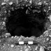
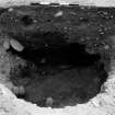
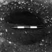
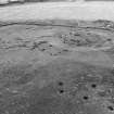
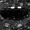
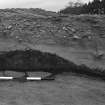
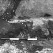
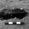
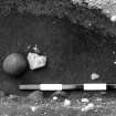
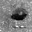
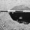
Oblique aerial view.Excavation photograph : trench 1, House RA, section of ditch.Excavation photograph : trench 1, House RA, section showing feature RA 174.Excavation photograph : trench III - pre excavation from tower, facing south.Excavation photograph : trench III - pre excavation from tower, facing south, showing edge of crescent shaped hollow.Excavation photograph : trench III - from cherry picker, showing pits south of crescent shaped hollow in trench 1.Excavation photograph : trench III - posthole AFH, half sectioned, part of post structure A.Excavation photograph : trench III - postholes AFA and AFB, half sectioned, part of post structure H.Excavation photograph : trench 1 - feature ACA, large pit, within House 3 (House 2 in publication)..Excavation photograph : trench IIIa - gully at terminal.Excavation photograph : trench IV - pre excavation from tower.Excavation photograph : trench IV - feature DAE, multifill posthole, pre ex.Excavation photograph : trench IV - feature DAD, pit with packing.Excavation photograph : trench IV - feature DAH, eastern-most ring-ditch, cut 2.Excavation photograph : trench IV - feature DAO, oblong pit in east house, half section.Excavation photograph : trench IV - feature DAH, radial section cut 13/13x.Excavation photograph : trench V - house 6 pre excavation, from tower.Excavation photograph : trench V - feature EBI, half section.Excavation photograph : trench V - feature EDE charcoal and burnt soil.Excavation photograph : trench V - House 6 after removal of paving.Excavation photograph : excavated feature.Excavation photograph : ditch section.Excavation photograph : pit? excavated.Excavation photograph : rectangular structures C and D - postholes excavated, from above.Excavation photograph : features.Excavation photograph : House 6, excavated.Excavation photograph : rectangular structures C and D.Excavation photograph : reconstruction model of Douglasmuir house.Excavation photograph : House 5 excavated.Excavation photograph : aerial shot of site under excavation.
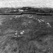
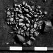
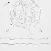
(dry mounted copy print filed at back of manuscript MS/983/7-12)Excavation photograph : trench I, feature ACL?Illustration 10 - plan of features of Iron Age settlement before excavation.Illustration 18 - House 4, excavated plan.Illustration 21 - House 6, excavated plan and profiles.Excavation photograph : aerial shot of excavated ring ditches.Excavation photograph : aerial shot of House 6 excavated.Excavation photograph Oblique aerial view centred on the cropmarks of the ring ditch houses and pits at Douglasmuir, looking to the NE.Oblique aerial view.Excavation photograph : trench 1, House RB, overall view.Excavation photograph : trench III extension and IIIa - post excavation showing post structure A and House 5 House 1 in publication).Excavation photograph : trench 1 - hexagonal structure B, east of House 3 (House 2 in publication).Excavation photograph : trench IIIa - House 5 (House 1 in publication) pre excavation from tower.Excavation photograph : trench IIIa - features CAA, CAV, pebble cluster.Excavation photograph : trench IIIa - feature CAA, half section, cutting 2.Excavation photograph : trench IIIa - features CAA and CAS, cutting 4.Excavation photograph : trench IIIa - feature CBA, cutting 3 axial.Excavation photograph : trench IV - feature DAB, multifill pit/posthole, half section.Excavation photograph : trench IV - features DAH, eastern-most ring-ditch, and DAP, pit/posthole on edge of it, sec. in cut 5.Excavation photograph : trench IV - feature DAH, eastern-most ring-ditch, cut 12, axial.Excavation photograph : trench V - feature EBM, half section.Excavation photograph : trench V - house 6 showing stone centre.Excavation photograph : trench V - feature EBT, half section.Excavation photograph : trench V - feature EBB, half section.Excavation photograph : trench V - feature EDA, north-east quadrant.Excavation photograph : trench V - feature EDE charcoal and burnt soil.Excavation photograph : trench V - features EDT and EDS, half sectioned.Excavation photograph : ditch section.Excavation photograph : pit excavated against baulk.Excavation photograph : section.Excavation photograph : feature excavated.Excavation photograph : half section of feature.Excavation photograph : trench IV, feature DAH, eastern-most ring-ditch, cut II during excavation, showing features cut into lower fill.Excavation photograph.Illustration 15 - House 2 - excavated plan and profiles.Illustration 24 - comparative plan of structures A-H.Excavation photograph : trench 1, House RA, feature.Excavation photograph : trench 1, House RA.Excavation photograph : trench 1, House RB paving.Excavation photograph : trench 1, House RA paving.Excavation photograph : trench III - from cherry picker, crescent shaped hollow.Excavation photograph : trench III - posthole AFK, half sectioned, part of post structure A.Excavation photograph : trench III - posthole AFJ, half sectioned, part of post structure A.Excavation photograph : trench III - posthole AFM, half sectioned, part of post structure A.Excavation photograph : trench 1 - features ACL and ABV, pits within ring-ditch AAT, House 3 (House 2 in publication), half sectioned.Excavation photograph : trench 1 - feature ABJ, posthole and ABK, pit, half sectioned, House 3 (House 2 in publication).Excavation photograph : trench 1 - features AAW and AAY, posthole and pit within AAT, ring-ditch, half sectioned, House 3 (House 2 in publication).Excavation photograph : trench IIIa - feature CAM, half section, cutting 1.Excavation photograph : trench IV - feature DAD, pit with packing, canted stones in fill.Excavation photograph : trench IV - feature DAC, small hole, post ex.Excavation photograph : trench IV - feature DAM, pit or part of west ring-ditch, half section.Excavation photograph : trench IV - rectangular structure D?Excavation photograph : trench IV - feature DAH, radial section cut 11.Excavation photograph : trench IV - feature DAH, radial section cut 9/9x.Excavation photograph : trench V - SW quad 04 and 05.Excavation photograph : trench V - feature EBC, half section.Excavation photograph : trench V - feature EBW, post excavation.Excavation photograph : half section of feature.Excavation photograph : half section of feature.Excavation photograph : stone filled feature.Excavation photograph : half section of feature from above.Excavation photograph : half section of feature.Excavation photograph : pits/postholes excavated.Excavation photograph : features?Excavation photograph : ditch section of ring-ditch house.Excavation photograph : trench II - fBEA, facing west.Illustration 11 - comparative plans of Douglasmuir houses showing probable structural postholes.Excavation photograph : trench 1, House RA, feature.Excavation photograph : aerial shot of House 6 excavated.Excavation photograph : trench 1, House RA paving.
First 100 images shown. See the Collections panel (below) for a link to all digital images.

Administrative Areas

  • Council Angus
  • Parish Inverkeilor
  • Former Region Tayside
  • Former District Angus
  • Former County Angus

Archaeology Notes

NO64NW 38 617 481.

NO 617 481. Settlement (Site), Douglasmuir: The crop-marks of what are probably three ring-ditch houses, each measuring about 10m in diameter, have been photographed in a level field SE of Douglasmuir. Nearby, at NO 616 479, a ring-ditch, measuring about 12m in diameter, and a number of indeterminate crop-marks were noted. Also, at NO 615 481, the crop-mark of a rectangular palisaded enclosure, measuring about 38m in length by 15m broad, was observed. The enclosure is bisected by a line of post-holes half-way along its length.

RCAHMS 1978

NO 617 481. The excavation of two out of a possible six ring-ditch houses was carried out as an initial season of excavation. Each house consisted of a penannular, segmented ring ditch with internal post-holes, about 10m diameter, about 10m apart. Fill of the features contained a number of saddle querns and several polished stone tools. The houses are thought to be of a Late Bronze Age type.

J Kendrick 1979

Six penannular ring-ditch houses dating to the first millenium BC were also excavated. The houses were of the broad ring-ditch type with internal beam support. Other features include six-post structures and crescent-shaped hollows which might be the truncated remains of further house sites. There was little horizontal stratigraphy.

J Kendrick 1995.

Activities

Field Visit (March 1978)

Douglasmuir NO 617 481 NO64NW

The crop-marks of what are probably three ring-ditch houses, each measuring about 10m in diameter, have been photographed in a level field SE of Douglasmuir. There is also a fourth ring-ditch without an entrance nearby.

RCAHMS 1978, visited March 1978

Note (1978)

Leys NO 616 479 NO64NW

In a field NE of Leys of Boysack, a ring-ditch, measuring about 12m in diameter, and a number of other indeterminate crop-marks, have been recorded.

RCAHMS 1978

Excavation (1979 - 1980)

NO 617 481. The excavation of two out of a possible six ring-ditch houses was carried out as an initial season of excavation. Each house consisted of a penannular, segmented ring ditch with internal post-holes, about 10m diameter, about 10m apart. Fill of the features contained a number of saddle querns and several polished stone tools. The houses are thought to be of a Late Bronze Age type.

J Kendrick 1979

References

MyCanmore Image Contributions


Contribute an Image

MyCanmore Text Contributions