 |
On-line Digital Images |
SC 1013272 |
Records of Aberdeen Aerial Surveys, Aberdeen, Scotland |
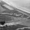
Oblique aerial view centred on the cropmarks of the unenclosed settlement, souterrain, ring ditches, enclosures, linear features and pits at Newbarns, looking to the NE. |
29/6/1982 |
Item Level |
|
 |
On-line Digital Images |
SC 1013482 |
Records of Aberdeen Aerial Surveys, Aberdeen, Scotland |
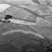
Oblique aerial view centred on the cropmarks of the enclosures, souterrains, barrows, ring ditches, linear features and pits at Newbarns, looking to the NE. |
8/7/1982 |
Item Level |
|
 |
On-line Digital Images |
SC 1013483 |
Records of Aberdeen Aerial Surveys, Aberdeen, Scotland |
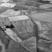
Oblique aerial view centred on the cropmarks of the enclosures, souterrains, barrows, ring ditches, linear features and pits at Newbarns, looking to the NW. |
8/7/1982 |
Item Level |
|
 |
On-line Digital Images |
SC 1013484 |
Records of Aberdeen Aerial Surveys, Aberdeen, Scotland |
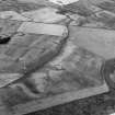
Oblique aerial view centred on the cropmarks of the enclosures, souterrains, barrows, ring ditches, linear features and pits at Newbarns, looking to the NNW. |
8/7/1982 |
Item Level |
|
 |
On-line Digital Images |
SC 1014658 |
Records of Aberdeen Aerial Surveys, Aberdeen, Scotland |
Oblique aerial view of the cropmarks of the unenclosed settlement at Newbarns, looking to the NW. |
18/7/1984 |
Item Level |
|
 |
On-line Digital Images |
DP 007736 |
RCAHMS Aerial Photography Digital |
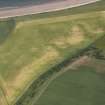
Oblique aerial view centred on the cropmarks of the unenclosed settlement and linear cropmarks, taken from the W. |
22/6/2006 |
Item Level |
|
 |
On-line Digital Images |
DP 091463 |
RCAHMS Aerial Photography Digital |
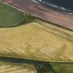
Oblique aerial view of the cropmarks of the round houses and field boundary, looking to the ENE. |
18/7/2010 |
Item Level |
|
 |
On-line Digital Images |
DP 166874 |
RCAHMS Aerial Photography Digital |
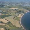
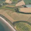
General oblique aerial view of the Newbarns area Lunan Bay, looking N. |
18/7/2013 |
Item Level |
|
 |
On-line Digital Images |
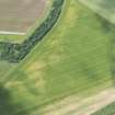
DP 166875 |
RCAHMS Aerial Photography Digital |
Oblique aerial view of the area of unenclosed settlement at Newbarns, Lunan Bay, looking SW. |
18/7/2013 |
Item Level |
|
 |
On-line Digital Images |
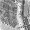
DP 216827 |
RCAHMS Aerial Photography Digital |
Oblique aerial view of the cropmarks of the round houses, looking WNW. |
9/7/2015 |
Item Level |
|
 |
On-line Digital Images |
SC 1721052 |
RCAHMS Aerial Photography |
Oblique aerial view. |
1982 |
Item Level |
|
 |
On-line Digital Images |
SC 1721090 |
RCAHMS Aerial Photography |
Oblique aerial view. |
1993 |
Item Level |
|
 |
On-line Digital Images |
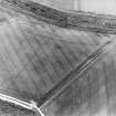
SC 1721134 |
RCAHMS Aerial Photography |
Oblique aerial view centred on possible field boundaries, taken from the NNE. |
7/7/1998 |
Item Level |
|
 |
On-line Digital Images |
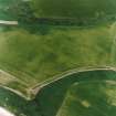
SC 1721137 |
RCAHMS Aerial Photography |
Oblique aerial view centred on the cropmarks of the unenclosed settlement, enclosures, possible souterrains, linear cropmarks and possible field boundaries, taken from the NE. |
15/6/2000 |
Item Level |
|
 |
On-line Digital Images |
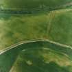
SC 1721138 |
RCAHMS Aerial Photography |
Oblique aerial view centred on the cropmarks of the unenclosed settlements, linear cropmarks and possible field boundaries, taken from the NE. |
15/6/2000 |
Item Level |
|
 |
On-line Digital Images |
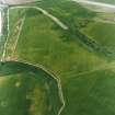
SC 1721139 |
RCAHMS Aerial Photography |
Oblique aerial view centred on the cropmarks of the unenclosed settlement, enclosures, possible souterrains, linear cropmarks and possible field boundaries, taken from the NNW. |
15/6/2000 |
Item Level |
|
 |
On-line Digital Images |
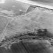
SC 1721140 |
RCAHMS Aerial Photography |
Oblique aerial view centred on the cropmarks of the unenclosed settlement, enclosures, possible souterrains, linear cropmarks and possible field boundaries, taken from the SW. |
15/6/2000 |
Item Level |
|
 |
On-line Digital Images |
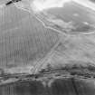
SC 1721141 |
RCAHMS Aerial Photography |
Oblique aerial view centred on the cropmarks of the unenclosed settlements, linear cropmarks and possible field boundaries, taken from the SSW. |
15/6/2000 |
Item Level |
|
 |
On-line Digital Images |
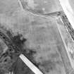
SC 1721143 |
RCAHMS Aerial Photography |
Oblique aerial view centred on the cropmarks of the unenclosed settlement, enclosures, possible souterrains, linear cropmarks and possible field boundaries, taken from the S. |
15/6/2000 |
Item Level |
|
 |
On-line Digital Images |
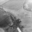
SC 1721144 |
RCAHMS Aerial Photography |
Oblique aerial view centred on the cropmarks of the unenclosed settlements, linear cropmarks and possible field boundaries, taken from the SSE. |
15/6/2000 |
Item Level |
|
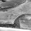 |
On-line Digital Images |
SC 1721147 |
RCAHMS Aerial Photography |
Oblique aerial view centred on the cropmarks of the unenclosed settlements, linear cropmarks and possible field boundaries, taken from the ENE. |
15/6/2000 |
Item Level |
|
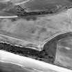 |
On-line Digital Images |
SC 1721148 |
RCAHMS Aerial Photography |
Oblique aerial view centred on the cropmarks of the unenclosed settlement, enclosures, possible souterrains, linear cropmarks and possible field boundaries, taken from the NE. |
15/6/2000 |
Item Level |
|
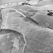 |
On-line Digital Images |
SC 1721149 |
RCAHMS Aerial Photography |
Oblique aerial view centred on the cropmarks of the unenclosed settlements, linear cropmarks and possible field boundaries, taken from the NNW. |
15/6/2000 |
Item Level |
|
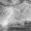 |
On-line Digital Images |
SC 1721153 |
RCAHMS Aerial Photography |
Oblique aerial view centred on the cropmarks of the unenclosed settlement, enclosures, possible souterrains, linear cropmarks and possible field boundaries, taken from the SW. |
6/7/2000 |
Item Level |
|


