
Pricing Change
New pricing for orders of material from this site will come into place shortly. Charges for supply of digital images, digitisation on demand, prints and licensing will be altered.
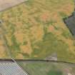
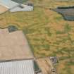
Ironshill


Unenclosed Settlement (Prehistoric)
Site Name Ironshill
Classification Unenclosed Settlement (Prehistoric)
Canmore ID 35421
Site Number NO64NE 41
NGR NO 672 497
Datum OSGB36 - NGR
Permalink http://canmore.org.uk/site/35421


- Council Angus
- Parish Inverkeilor
- Former Region Tayside
- Former District Angus
- Former County Angus

