Newbarns
Ring Ditch(S) (Prehistoric), Unenclosed Settlement (Prehistoric)
Site Name Newbarns
Classification Ring Ditch(S) (Prehistoric), Unenclosed Settlement (Prehistoric)
Canmore ID 35394
Site Number NO64NE 18
NGR NO 68444 49391
NGR Description NO 6844 4939, NO 6835 4947 and NO 6844 4930
Datum OSGB36 - NGR
Permalink http://canmore.org.uk/site/35394
- Council Angus
- Parish Inverkeilor
- Former Region Tayside
- Former District Angus
- Former County Angus
NO64NE 18 NO 68474 49352
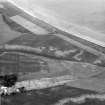
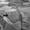
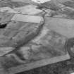
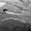
NO 684 493. At least three circular crop-marks measuring up to 10m in diameter have been noted N of Newbarns. Close to them is a C-shaped mark, which measures about 15m across.
RCAHMS 1978
NO 680 490 (centre) A programme of trial trenching was carried out on adjoining fields, one Scheduled and one unscheduled, to the N of Newbarns Farm.
In the unscheduled field, three groups of cropmarks (NMRS NO64NE 18) were targeted with five trenches, each measuring 25 x 1.5m. Two trenches were excavated across a ring-ditch feature, c 7m in maximum diameter. Three widely spaced post-holes, one of which had been recut, were located approximately 1m outside the ring-ditch.
A trench was excavated across a c 40m long crescent-shaped cropmark. This proved to be a shallow, charcoal-rich lens 0.25m deep and 4m wide.
The remaining two trenches were excavated over what appeared on aerial photographs to be a concentration of pit/post-holes. No significant concentration of features was identified, one trench producing four widely spaced, small, shallow pits; the other producing two similar features.
In the Scheduled field, four groups of cropmarks were targeted with four trenches. A kidney-shaped cropmark proved to be a modern feature.
A trench was excavated over the northermost third of a semi-circular ditch (NMRS NO64NE 18) with a radius of c 12m. This appeared prior to excavation to be associated with many pits and post/stake-holes. The ditch was 0.7m deep, with almost vertical sides and a flat base. A section at the terminus revealed a gentle rise to the subsoil surface.
Four round pits appeared to be associated with this feature, two being inside it and two just beyond the terminus. All had fills similar to that of the ditch. Two of the pits were excavated and both contained pottery fragments, one of which was a decorated Beaker rim sherd. A flint artefact was retrieved from the same pit. Both the pits and the ditch contained some heat-cracked stones in their charcoal-rich fills. Immediately to the N of the terminus, and outside the ditch, was an oval hollow measuring 4 x 3m, by 0.35m deep, which lay slightly off-centre to a ring of 10 stake/post-holes, one of which was cut by the ditch.
A trench was excavated over a second ring-ditch (NMRS NO64NE 18) and associated pits and post-holes. This ring-ditch measured 7m in diameter. Five post-holes were identified.
The function of these ring-ditches was not immediately apparent. There was no evidence that they were foundations for post-built structures and no significant features were identified within them. It seems most likely that they represent the vestiges of round barrows. These monuments are known to occur in the area, such as the Scheduled example at nearby Corbie Knowe (NMRS NO64NE 4).
Fourteen additional features, comprising a ditch terminus, a large pit and twelve smaller pits were located in this trench. Of the excavated sample, none produced any finds.
A detailed report will be lodged with the NMRS.
Sponsors: Historic Scotland, University of Edinburgh.
C McGill 1998
NO 683 492 The second season of a programme of trial trenching was carried out to the W of Newbarns Farm (McGill 1998). The field is rich in cropmarks of varying forms, some of which are Scheduled.
Eleven trenches were excavated: three within the Scheduled area and eight outside it. Of this total, only two trenches were devoid of archaeological features.
The excavated features comprised pits, linear ditches, natural ice wedges, a truncated ring-ditch house, a sub-rectangular enclosure (possibly a Dark Age timber hall), and a possible square barrow. No features produced any artefactual dating evidence, and provisional dates can only be applied to three feature groups (the ring-ditch house, timber hall and square barrow-type feature) on the basis of their morphology. The results supported the conclusions from the previous year's work at Newbarns that the clarity of cropmarks is the result of a combination of topography, ploughsoil depth, subsoil, feature depth, size and nature of fill, with the principal deciding factor being geomorphological considerations. There was considerable evidence across the site for plough-scoring of subsoil and features, suggesting that active truncation is occurring.
A detailed report will be lodged with NMRS.
Sponsors: Historic Scotland, University of Edinburgh.
C McGill 1999
Field Visit (March 1978)
New Barns 2 NO 684 493 NO64NE
At least three circular crop-marks measuring up to 10m in diameter have been noted N of New Barns. Close to them there is a C-shaped mark, which measures about 15m across.
RCAHMS 1978, visited March 1978
Aerial Photographic Transcription (24 February 1994 - 21 April 1994)
An aerial transcription was produced from oblique aerial photographs. Information from Historic Environment Scotland (BM) 31 March 2017.


