
Balcathie


Four Poster Stone Circle (Bronze Age)(Possible), Pit(S) (Period Unknown), Rig And Furrow (Medieval) - (Post Medieval), Unenclosed Settlement (Period Unknown)
Site Name Balcathie
Classification Four Poster Stone Circle (Bronze Age)(Possible), Pit(S) (Period Unknown), Rig And Furrow (Medieval) - (Post Medieval), Unenclosed Settlement (Period Unknown)
Canmore ID 35378
Site Number NO63NW 3
NGR NO 606 391
Datum OSGB36 - NGR
Permalink http://canmore.org.uk/site/35378


- Council Angus
- Parish Arbirlot
- Former Region Tayside
- Former District Angus
- Former County Angus
NO63NW 3 606 391.
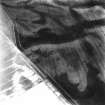
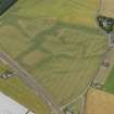
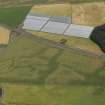
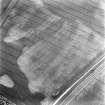
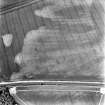
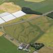
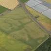
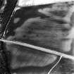
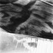
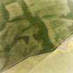
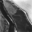
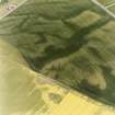
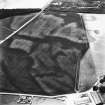
NO 606 391. Ring-ditches, Balcathie: visible on RCAHMS aerial photographs taken in 1979.
Aerial photography has recorded the cropmarks of several ring-ditches and pit features scattered across a field 250m W of Cotton of Balcathie. Probable settlement remains include at least three faint crescentic marks (probably houses) with further arcs of ditch and crescentic shapes representing some six further ring-ditches. Possible short double pit-alignments are visible at c.NO 6070 3921 and c.NO 6051 3914, each no more than 12m long. In the same field, cropmarks of further pit-defined features, souterrains and an enclosure (NO63NW 11) have been recorded.
Information from RCAHMS (KB) 12 April 1999

