
Ardhallow Battery


Boundary Stone (20th Century)
Site Name Ardhallow Battery
Classification Boundary Stone (20th Century)
Alternative Name(s) Rockvale
Canmore ID 352947
Site Number NS17SE 6.39
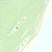
NGR NS 16308 74008
Datum OSGB36 - NGR
Permalink http://canmore.org.uk/site/352947

- Council Argyll And Bute
- Parish Dunoon And Kilmun
- Former Region Strathclyde
- Former District Argyll And Bute
- Former County Argyll
Desk Based Assessment (7 March 2017)
The land on which the Ardhallow Battery was built was bought by the War Office in 1899 and the extent of this area was defined by a series of boundary stones consecutively numbered from 1 to 12. When an additional parcel of ground was added to the S end of the area in 1907 that boundary was redrawn. Stones 7-12 all appear to have remained in place but stones 1, 5 and 6 were moved to reflect the new boundary. Stones 2, 3 and 4 were deemed redundant, something that is reflected in the inscription on stone 1 which indicates that the gap between stone 1 and stone 5 in their new positions was defined only by a straight length of field wall (FW). Accordingly, there is nothing now to see at the original position of stone 1 – by the roadside 30m E of the house known as ‘Rockvale’. The stone is described elsewhere (see NS17SE 6.12).
Information from HES Survey and Recording (JRS) 7 March 2017.

