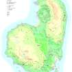
Eigg, Struidh
Building(S), Midden, Pen(S), Rock Shelter, Shieling Hut(S), Shieling Mound(S)
Site Name Eigg, Struidh
Classification Building(S), Midden, Pen(S), Rock Shelter, Shieling Hut(S), Shieling Mound(S)
Canmore ID 352879
Site Number NM48NE 186
NGR NM 49655 89182
Datum OSGB36 - NGR
Permalink http://canmore.org.uk/site/352879
- Council Highland
- Parish Small Isles
- Former Region Highland
- Former District Lochaber
- Former County Inverness-shire
Field Visit (23 April 2002)
This very large group of at least 66 structures is situated on a broad boulder-strewn terrace between the cliffs of Beinn Bhuidhe and the coastline to the east, to the NE of a small farmstead (NM48NE 40). The group is spread over an area which measures about 240m from N to S by 175m transversely and all but four of the structures stand to the N of a unnamed stream. Most are presumably associated with shieling activity in the area, providing shelter to those acting as herdsman. The groups includes at least 21 huts, 36 mounds, four pens, two buildings, a rock shelter, and a possible peat stand.
The 21 shieling huts are generally sub-rectangular on plan and measure up to 6.9m in length by 3m in breadth within stone and/or turf walls up to 1.2m in thickness and averaging 0.5m in height. Some are constructed against boulders, while three are built on top of earlier mounds. One example (1203; NM 49714 89216) has a second compartment at the SSW end. Midden material was identified in two of the huts (1174 and 1178). The 36 shieling mounds, probably the remains of earlier huts, are grass-grown and sub-rectangular on plan. Most have either a dimpled top (representing the interior of a hut) or fragments of stonework on the surface. The largest (999; NM 49668 89269) measures 10m from N to S by 6.3m transversely and 0.3m in height. A single rock shelter (1189) at NM 49557 89257 may have functioned in much the same way as a hut. It consists of a stretch of drystone wall 0.5m high enclosing an area 2.5m by 1.5m under an overhanging boulder, and midden material is visible on the floor.
A building (1204) stands at the NE of the group (NM 49714 89279) on a terrace, and perhaps represents an effort are more permanent occupation related to the farmstead. It measures 9.3m from E to W by 3.4m transversely within a faced rubble wall 0.9m in thickness and 1.2m in height, and there is a later pen in the NW corner. Another possible building (993), much reduced and smaller in size, stands at NM 49715 89069. While some of the pens are relatively late in the sequence (standing within earlier buildings), and perhaps represent the activity of later shepherds, two are larger and may be contemporary with the shieling activity (1179, 1192).
Finally there is a possible peat stand (513) at NM 49793 89087. It measures 7.3m from E to W by 1.4m transversely within a boulder kerb 0.3m in thickness and 0.3m in height. The interior is now filled with boulders.
EIGG01 513, 993-9, 1139, 1142-87, 1189, 1192, 1200-04, 1206-7
Visited by RCAHMS (SDB and AGCH) 23 April 2002


