Ardhallow Battery
Gun Emplacement (First World War)
Site Name Ardhallow Battery
Classification Gun Emplacement (First World War)
Canmore ID 352870
Site Number NS17SE 6.10
NGR NS 16263 74204
Datum OSGB36 - NGR
Permalink http://canmore.org.uk/site/352870
- Council Argyll And Bute
- Parish Dunoon And Kilmun
- Former Region Strathclyde
- Former District Argyll And Bute
- Former County Argyll
Field Visit (16 June 2016)
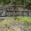
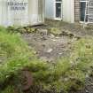
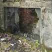
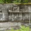
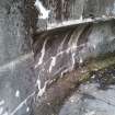
The remains of this large 9.2-inch gun emplacement survive to full height and as depicted on the plan in The National Archives (WO 78/5186). At its centre is the gun-pit, where two rings of bolts of the holdfast are visible in the floor, as is the course of the pipe trench that ran from the holdfast to an accumulator that was located in a sealed-up niche in the E wall. The emplacement was open to the NW but enclosed by a concrete wall about 2.5m high that supported the rear of the glacis on the NE, SE and SW. Originally a raised loading platform of metal and wood construction would have existed around the SW arc of the gun, which would have been in part secured by tying it to six anchor points set into the massive concrete wall. The location of these points remain visible, but the hold-rings to which the ties would have been attached have been removed. Other features of the wall include four electric light recesses and additional niches or cupboards for tools, as well as a curved shell recess which measures about 1 m in height and extends around most of the internal wall-face from ENE to S. In the SE arc there is a doorway-sized recess for instruments, battery and dials, as well as a shell and cartridge hoist which retains evidence of electrical and other fixings. At the rear of the gun pit, on both the NE and SW ends, the walls change direction, that on the NE turning NE, that on the SW turning to the SW. The NE wall contains two cartridge recesses which originally had metal doors. There are now no visible remains of the underground magazine and crew shelter which lay immediately SW of the emplacement.
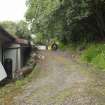
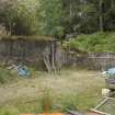
Immediately to the NNE of the emplacement, and attached to the concrete wall that runs NE from it, are the remains of the battery workshop. Most of the building has been demolished but its SW end-wall and most of its SE side-wall have been incorporated into a new workshop built on the footprint of its predecessor. A step on the outside face of the original walls suggests that earth was originally piled up against them as indicated on a plan of the battery in the National Archives.
Visited by HES Survey and Recording (AKK) 16 June 2016.


