
Cloch Point


Gun Emplacement (First World War)
Site Name Cloch Point
Classification Gun Emplacement (First World War)
Canmore ID 352640
Site Number NS27NW 21.27
NGR NS 20486 75863
Datum OSGB36 - NGR
Permalink http://canmore.org.uk/site/352640


- Council Inverclyde
- Parish Inverkip
- Former Region Strathclyde
- Former District Inverclyde
- Former County Renfrewshire
Field Visit (2 March 2016)
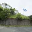
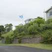
The northerly of the two gun emplacements in the caravan park at Cloch Point is situated on a W-facing terrace some 43m from its neighbour (see NS27NW 21.26). The emplacement appears to have been filled in and its top levelled to produce a stance now occupied by two static caravans. The cast concrete wall (up to 1.5m high) which retained the bottom of the glacis around the front of the emplacement is still visible although most of the original earthwork is now obscured by more recent landscaping.
Visited by HES Survey and Recording (AKK, GG) 2 March 2016.

