Accessibility

Font Size

100% 150% 200%

Background Colour

Default Contrast
Close Reset

Whistlefield

No Class (Event) (Period Unassigned)

Site Name Whistlefield

Classification No Class (Event) (Period Unassigned)

Canmore ID 350941

Site Number NT53SW 279

NGR NT 53114 34247

Datum OSGB36 - NGR

Permalink http://canmore.org.uk/site/350941

Ordnance Survey licence number AC0000807262. All rights reserved.
Canmore Disclaimer. © Bluesky International Limited 2025. Public Sector Viewing Terms

Toggle Aerial | View on large map

Digital Images

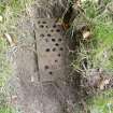
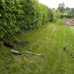
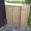
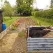
Metal detecting survey, Iron gate, Whistlefield, Darnick
Metal detecting survey, Iron gate, Whistlefield, DarnickMetal detecting survey, Location shot, Whistlefield, DarnickMetal detecting survey, Entrance to grounds with padlock previously cut, Whistlefield, DarnickMetal detecting survey, General shot of site, Whistlefield, DarnickMetal detecting survey, Shot showing stepping of landscape, Whistlefield, DarnickMetal detecting survey, General shot of site, Whistlefield, DarnickMetal detecting survey, General shot of site, Whistlefield, Darnick

Administrative Areas

  • Council Scottish Borders, The
  • Parish Melrose
  • Former Region Borders
  • Former District Ettrick And Lauderdale
  • Former County Roxburghshire

Activities

Metal Detector Survey (1 June 2016)

NT 531 342 A metal detector survey was undertaken, 1 June 2016, on land N of Lye Road, Darnick, in advance of development work. The work recovered no finds and this may be due in part to extensive landscaping undertaken in the creation of the cottages and gardens along the Lye Road.

Archive: NRHE (intended)

Funder: Mr P Burns

Steven Watt – AOC Archaeology Group

(Source: DES, Volume 17)

References

MyCanmore Image Contributions


Contribute an Image

MyCanmore Text Contributions