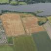
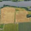
Accessibility

Font Size

100% 150% 200%

Background Colour

Default Contrast
Close Reset

Forfar

Field Boundary (Period Unknown), Rig And Furrow (Medieval) - (Post Medieval)

Site Name Forfar

Classification Field Boundary (Period Unknown), Rig And Furrow (Medieval) - (Post Medieval)

Alternative Name(s) Inchgarth

Canmore ID 350326

Site Number NO45SW 60

NGR NO 44530 50920

Datum OSGB36 - NGR

Permalink http://canmore.org.uk/site/350326

Ordnance Survey licence number AC0000807262. All rights reserved.
Canmore Disclaimer. © Bluesky International Limited 2025. Public Sector Viewing Terms

Toggle Aerial | View on large map

Digital Images

Oblique aerial view of the cropmarks of the field boundary and rig, looking E.
Oblique aerial view of the cropmarks of the field boundary and rig, looking E.Oblique aerial view of the cropmarks of the field boundary and rig, looking E.

Collections

Administrative Areas

  • Council Angus
  • Parish Forfar
  • Former Region Tayside
  • Former District Angus
  • Former County Angus

Activities

Aerial Photography (31 July 2013)

References

MyCanmore Image Contributions


Contribute an Image

MyCanmore Text Contributions