
Pricing Change
New pricing for orders of material from this site will come into place shortly. Charges for supply of digital images, digitisation on demand, prints and licensing will be altered.
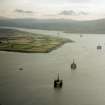
Ferryton Point


Track (Period Unassigned)
Site Name Ferryton Point
Classification Track (Period Unassigned)
Canmore ID 349082
Site Number NH66NE 154
NGR NH 68030 67060
Datum OSGB36 - NGR
Permalink http://canmore.org.uk/site/349082

- Council Highland
- Parish Resolis
- Former Region Highland
- Former District Ross And Cromarty
- Former County Ross And Cromarty
Field Visit (1996)
The track starts from the tarred, public road goes downhill towards the sea, turns right above the shore in front of the Ferryton Girnal (now a private house) and then in a northerly direction to the beach. This track is shown on old maps and has probably been in existance at least back to c. 1750, when the girnal was built.
Visited by Scotland's Coastal Heritage at Risk (SCHARP) 1996

