Pricing Change
New pricing for orders of material from this site will come into place shortly. Charges for supply of digital images, digitisation on demand, prints and licensing will be altered.
Haughs Of Finavon
Enclosure (Prehistoric)(Possible), Linear Feature(S) (Period Unknown)
Site Name Haughs Of Finavon
Classification Enclosure (Prehistoric)(Possible), Linear Feature(S) (Period Unknown)
Canmore ID 34834
Site Number NO55NW 50
NGR NO 50261 57692
Datum OSGB36 - NGR
Permalink http://canmore.org.uk/site/34834
- Council Angus
- Parish Oathlaw
- Former Region Tayside
- Former District Angus
- Former County Angus
NO55NW 50 5025 5771.
Excavation in advance of A94 widening revealed poor survival due to gravel extraction in the 1970s.
E Halpin 1987.
Aerial Photography (September 1970)
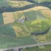
Oblique aerial photographs of Finavon Roman temporary camp and the cropmarks at Haughs of Finavon, taken by Mr John Dewar in 1970.
Note (1983)
Haughs of Finavon NO 502 577 NO55NW
Cropmarks reveal three sides of a rectangular enclosure, probably a settlement, on the S side of the public road (A94) 450m NNW of Haughs of Finavon steading; it has rounded corners, and measures 48.5m by at least 25.6m internally. Excavation has shown that the ditch measures 4. 7m in breadth by 1.1 m in depth.
RCAHMS 1983.


