Scheduled Maintenance
Please be advised that this website will undergo scheduled maintenance on the following dates: •
Tuesday 3rd December 11:00-15:00
During these times, some services may be temporarily unavailable. We apologise for any inconvenience this may cause.
Hynd Castle
Tower House (Medieval)
Site Name Hynd Castle
Classification Tower House (Medieval)
Alternative Name(s) West Skichen
Canmore ID 34713
Site Number NO54SW 10
NGR NO 50497 41568
Datum OSGB36 - NGR
Permalink http://canmore.org.uk/site/34713
- Council Angus
- Parish Monikie
- Former Region Tayside
- Former District Angus
- Former County Angus
NO54SW 10.00 50497 41568
NO54SW 10.01 NO 5050 4157 Whorl
(NO 5050 4157) Hynd Castle (NR) (remains of)
OS 6" map, (1970)
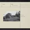
The ruins of Hynd Castle stand on a rounded mound (apparently artificial), close by the Dundee-Brechin road. The remains comprise an area c.12' square with wall c.10' high, and c.5' thick. A doorway exists on one side, and a window on each of the other three sides. The Castle had at one time been surrounded by water and a morass.
A J Warden 1880-5.
The ruins of a small tower, 8.6m square, situated on a round-topped knoll which appears to be more natural than artificial, It is 4m high on the south, and 6m on the north, where the slope is much steeper. The walls of the tower are 2.4m thick, leaving a small internal compartment only 3.6m square. The walls attain a maximum height of 2.5m internally and 3.0m externally. Breaks in the centres of all walls except the west, are indicative of the narrowing openings of windows, or shot-holes; but these features are too far destroyed to be identified as such. The opening on the west was probably the entrance.
The walls of the ruin are of coursed rubble and in crumbling condition. 4 metres east of the Castle are the foundations of a small rectilinear enclosure measuring 6 x 5m. The earth-covered walls appear to be only 1m wide and are only 0.3m high. This structure is possibly much later than the Castle, and is not defensive in character. An old stone wall - probably an old field bank - 1m wide x 0.3m high, runs over the knoll west of the ruin and seems to have no strategic value.
Visited by OS (JLD) 4 June 1958.
As described.
Resurveyed at 1:2500.
Visited by OS (RD) 11 May 1966.


