
Following the launch of trove.scot in February 2025 we are now planning the retiral of some of our webservices. Canmore will be switched off on 24th June 2025. Information about the closure can be found on the HES website: Retiral of HES web services | Historic Environment Scotland
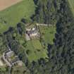
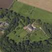
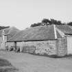
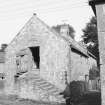
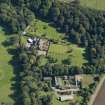
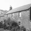
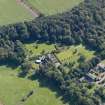
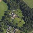
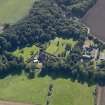
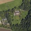
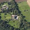
Mains Of Gardyne, Farmhouse


Farmhouse (Period Unassigned)
Site Name Mains Of Gardyne, Farmhouse
Classification Farmhouse (Period Unassigned)
Alternative Name(s) Gardyne Castle Policies
Canmore ID 34637
Site Number NO54NE 7.04
NGR NO 57263 48768
Datum OSGB36 - NGR
Permalink http://canmore.org.uk/site/34637


- Council Angus
- Parish Kirkden
- Former Region Tayside
- Former District Angus
- Former County Angus
NO54NE 7.04 57263 48768
For associated steading (NO 57249 48726), see NO54NE 7.05.
Formerly entered as NO54NE 33.00.

