Accessibility

Font Size

100% 150% 200%

Background Colour

Default Contrast
Close Reset

Damside

Pit Alignment (Prehistoric)

Site Name Damside

Classification Pit Alignment (Prehistoric)

Canmore ID 34621

Site Number NO54NE 19

NGR NO 578 495

Datum OSGB36 - NGR

Permalink http://canmore.org.uk/site/34621

Ordnance Survey licence number AC0000807262. All rights reserved.
Canmore Disclaimer. © Bluesky International Limited 2025. Public Sector Viewing Terms

Toggle Aerial | View on large map

Digital Images

Oblique aerial view centred on the cropmarks of an enclosure, pit alignment and rig at Damside, looking to the ESE.
Oblique aerial view centred on the cropmarks of an enclosure, pit alignment and rig at Damside, looking to the ESE.Oblique aerial view.Oblique aerial view.Oblique aerial view.Oblique aerial view centred on the cropmarks of an enclosure, pit alignment and rig at Damside, looking to the ENE.Oblique aerial view.Oblique aerial view centred on the cropmarks of an enclosure, pit alignment and rig at Damside, looking to the ESE.Damside, NO54NE 19, Ordnance Survey index card, RectoDamside, NO54NE 19, Ordnance Survey index card, RectoOblique aerial view.Oblique aerial view.Oblique aerial view.

Administrative Areas

  • Council Angus
  • Parish Kirkden
  • Former Region Tayside
  • Former District Angus
  • Former County Angus

Archaeology Notes

NO54NE 19 578 495.

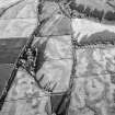
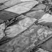
Single, curved pit alignment, running N-S for 40m, at right angles to the Vinny Water. There is no visible reason for its deviation from a straight course, but this may have been to avoid a structure since destroyed. A linear feature, broken into small sections, runs approximately parallel to the pit alignment, which lies 40m to the E. The relationship between them is not known.

L Macinnes 1983.

References

MyCanmore Image Contributions


Contribute an Image

MyCanmore Text Contributions