
Following the launch of trove.scot in February 2025 we are now planning the retiral of some of our webservices. Canmore will be switched off on 24th June 2025. Information about the closure can be found on the HES website: Retiral of HES web services | Historic Environment Scotland
Woodhill House


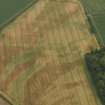
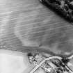
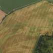
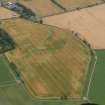
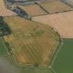
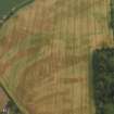
Rig And Furrow (Medieval) - (Post Medieval)
Site Name Woodhill House
Classification Rig And Furrow (Medieval) - (Post Medieval)
Canmore ID 34596
Site Number NO53SW 31
NGR NO 520 348
Datum OSGB36 - NGR
Permalink http://canmore.org.uk/site/34596


- Council Angus
- Parish Barry
- Former Region Tayside
- Former District Angus
- Former County Angus
NO53SW 31 520 348.
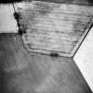
SOUTERRAIN (POSSIBLE) AT NO 5240 3483 (See NO53SW 65)
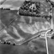
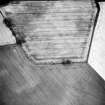
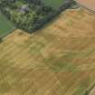
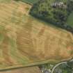
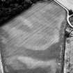
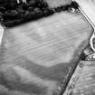
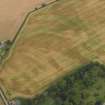
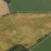
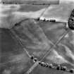
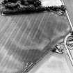
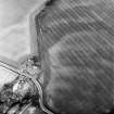
Cropmarks of rig and furrow cultivation revealed by aerial photography are visible running across two fields immediately to the E of the Woodhill steading's dam. At least four patches of rig have been recorded, the largest two centred on NO 520 346 (running NE-SW) and NO 522 348 (NNW-SSE). Various cropmarks are scattered across these fields, and these include a group of indeterminate marks at NO 5183 3459, and an oval marking 55m to the NNE. Two possible souterrains have also been recorded amidst the rig (NO53SW 32 and NO53SW 65 ).
Information from RCAHMS (KB) 23 April 1999

