
Greenlawhill


Cultivation Remains (Period Unknown), Enclosure(S) (Period Unknown), Unenclosed Settlement (Prehistoric)
Site Name Greenlawhill
Classification Cultivation Remains (Period Unknown), Enclosure(S) (Period Unknown), Unenclosed Settlement (Prehistoric)
Canmore ID 34581
Site Number NO53SW 18
NGR NO 5402 3469
NGR Description Centred on NO 5402 3469
Datum OSGB36 - NGR
Permalink http://canmore.org.uk/site/34581


- Council Angus
- Parish Barry
- Former Region Tayside
- Former District Angus
- Former County Angus
Archaeological Evaluation (June 2004)
NO53SW 18 centred on 5402 3469
From 539 346 to 543 347
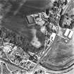
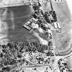
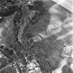
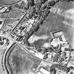
NO 540 346 (centre) An archaeological evaluation was undertaken in June 2004 in advance of residential development near areas of prehistoric activity (NO53SW 18; NO53SW 35) on the N side of the proposed development area. Four trenches were machine-excavated, covering an area of c 300m². Several features were uncovered, cut into natural sand and gravel, comprising mainly shallow ditches and possible pits. One large ditch, a cut or slot with associated stake-holes, a post-hole and a stone setting were also found. No dating evidence was recovered but it is considered that these features represent prehistoric activity, possibly associated with sites identified close to the N side of the site. It is possible that the stone setting represented the truncated ploughed-out remains of a short cist.
Archive to be deposited in the NMRS.
Sponsor: D J Laing Homes Ltd.
R Cachart 2004
Aerial Photographic Transcription (30 June 2017)
An interpretative transcription, or mapping, of information on oblique aerial photographs was produced on 30 June 2017.

