Pricing Change
New pricing for orders of material from this site will come into place shortly. Charges for supply of digital images, digitisation on demand, prints and licensing will be altered.
Upcoming Maintenance
Please be advised that this website will undergo scheduled maintenance on the following dates:
Thursday, 9 January: 11:00 AM - 3:00 PM
Thursday, 23 January: 11:00 AM - 3:00 PM
Thursday, 30 January: 11:00 AM - 3:00 PM
During these times, some functionality such as image purchasing may be temporarily unavailable. We apologise for any inconvenience this may cause.
Scryne Smithy
Enclosure (Prehistoric)
Site Name Scryne Smithy
Classification Enclosure (Prehistoric)
Alternative Name(s) East Scryne Hall
Canmore ID 34492
Site Number NO53NE 13
NGR NO 5858 3660
Datum OSGB36 - NGR
Permalink http://canmore.org.uk/site/34492
- Council Angus
- Parish Panbride
- Former Region Tayside
- Former District Angus
- Former County Angus
NO53NE 13 5858 3660.
Rectilinear.
(Undated) information from RCAHMS.
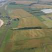
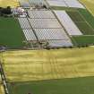
This monument comprises the remains of a sub-rectangular enclosed settlement of prehistoric date represented by cropmarks visible on oblique aerial photographs. It lies in arable farmland at around 20-25m OD and comprises a sub-rectangular enclosure measuring about 40m by 50m and defined by a ditch some 2-3m wide.
Information from Historic Scotland, scheduling document dated 4 March 1997.
Aerial Photographic Transcription (26 July 2017)
An interpretative transcription, or mapping, of information on oblique aerial photographs was produced on 26 July 2017.


