
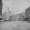
Edinburgh, Fountainbridge, Iron Foundry


Iron Foundry (19th Century) - (20th Century)
Site Name Edinburgh, Fountainbridge, Iron Foundry
Classification Iron Foundry (19th Century) - (20th Century)
Alternative Name(s) Hopetoun Iron Foundry
Canmore ID 340763
Site Number NT27SW 4752
NGR NT 24647 72921
Datum OSGB36 - NGR
Permalink http://canmore.org.uk/site/340763

- Council Edinburgh, City Of
- Parish Edinburgh (Edinburgh, City Of)
- Former Region Lothian
- Former District City Of Edinburgh
- Former County Midlothian
Note (June 2014)
'Hopetoun Iron Foundry' depicted and named on the Ordnance Survey 1st edition plan, 1:10560 (Edinburgh, 1851, sheet 38) and covered an area of approximately 667 square metres.
Information from Internet, http://maps.nls.uk/view/74415495 [accessed 19 June 2014]
This iron foundry came into being as a direct result of the building of the Union Canal. It is not depicted on the 'Plan of the City of Edinburgh including all the latest and intended improvements', John Wood, 1823 (the Canal was completed in 1822).
Information from Internet, http://maps.nls.uk/view/74400026 [accessed 19 June 2014]
Information from RCAHMS (MMD), 19 June 2014.

