
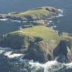
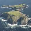
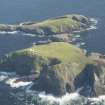
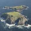
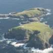
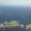
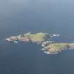
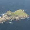
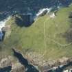
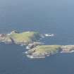
Flannan Isles, Eilean Mor, Tom Na Geodha


Wall (Period Unassigned)
Site Name Flannan Isles, Eilean Mor, Tom Na Geodha
Classification Wall (Period Unassigned)
Canmore ID 334075
Site Number NA74NW 7
NGR NA 72379 46858
Datum OSGB36 - NGR
Permalink http://canmore.org.uk/site/334075


- Council Western Isles
- Parish Uig
- Former Region Western Isles Islands Area
- Former District Western Isles
- Former County Ross And Cromarty
Aerial Photography (6 September 2013)
A ruinous stone wall cuts across the neck of land separating Tom na Geodha from the rest of Eilean Mor.
Information from RCAHMS (DCC) 6 January 2014

