
Pricing Change
New pricing for orders of material from this site will come into place shortly. Charges for supply of digital images, digitisation on demand, prints and licensing will be altered.
Leuchars Castle


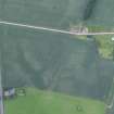
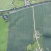
Enclosure (Period Unassigned)(Possible), Rig And Furrow (Medieval) - (Post Medieval)
Site Name Leuchars Castle
Classification Enclosure (Period Unassigned)(Possible), Rig And Furrow (Medieval) - (Post Medieval)
Canmore ID 33208
Site Number NO42SE 29
NGR NO 45048 22090
Datum OSGB36 - NGR
Permalink http://canmore.org.uk/site/33208


- Council Fife
- Parish Leuchars
- Former Region Fife
- Former District North East Fife
- Former County Fife
NO42SE 29 NO 45048 22090
Aerial Photographic Transcription (27 July 1990 - 29 August 1990)
An aerial transcription was produced from oblique aerial photographs. Information from Historic Environment Scotland (BM) 31 March 2017.

