Pricing Change
New pricing for orders of material from this site will come into place shortly. Charges for supply of digital images, digitisation on demand, prints and licensing will be altered.
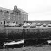
Lower Largo, Pier
Pier (19th Century)
Site Name Lower Largo, Pier
Classification Pier (19th Century)
Alternative Name(s) Largo Pier; Lower Largo, Harbour; Keil Burn; Firth Of Forth; Outer Forth Estuary
Canmore ID 32846
Site Number NO40SW 75
NGR NO 41661 02504
Datum OSGB36 - NGR
Permalink http://canmore.org.uk/site/32846
- Council Fife
- Parish Largo
- Former Region Fife
- Former District North East Fife
- Former County Fife
NO40SW 75 41661 02504
Pier [NAT]
OS (GIS) MasterMap, August 2010.
Location formerly entered as centred NO 4167 0251.
(Location cited as NO 417 025). Largo Pier, 19th century. Irregular rubble pier protecting the mouth of a small stream.
J R Hume 1976.
19th century rubble construction pier.


