Pricing Change
New pricing for orders of material from this site will come into place shortly. Charges for supply of digital images, digitisation on demand, prints and licensing will be altered.
Barns Of Airlie
Souterrain (Prehistoric)(Possible)
Site Name Barns Of Airlie
Classification Souterrain (Prehistoric)(Possible)
Canmore ID 32385
Site Number NO35SW 43
NGR NO 3052 5152
Datum OSGB36 - NGR
Permalink http://canmore.org.uk/site/32385
- Council Angus
- Parish Airlie
- Former Region Tayside
- Former District Angus
- Former County Angus
NO35SW 43 3052 5152
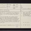
(NO 3052 5152) (information from F T Wainwright). A souterrain (ie in addition to NO35SW 19, NO35SW 35, NO35SW 42 ) existed on the farm of Barns of Airlie (NO 310 516) but was destroyed before 1864 (Jervise 1865).
On 24 June 1951 Wainwright (1963) and D B Taylor noted a possible location for this or another souterrain settlement, ie a heavy concentration of boulders and slabs spread over an area of two or three thousand square feet in the field adjoining the entrance to NO35SW 19 and NO35SW 150 ' to 200' from it. The farmer could give no further information and only excavation can confirm the site.
A Jervise 1865; F T Wainwright 1963.
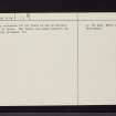
A pronounced natural (?) amorphous rise is evident at the map reference (information from Mr Lang, Mains of Airlie, Kirriemuir) but there is now no surface spread of stone. The field, now under pasture, is regularly ploughed.
Visited by OS (MFJ) 10 March 1977.
Note (1983)
Barns of Airlie 2 NO 305 515 NO35SW 43
A scatter of sandstone slabs 55m W of NO35SW 43 may mark the position of a souterrain.
RCAHMS 1983.
(Jervise 1864, 354; Wainwright 1963, 157-8).
Publication Account (1987)
This is one of the best preserved souterrains in Angus, for the roof remains intact except where a lintel has been removed to make access possible today. The gallery is some 19 m long and 2 m broad and is lintelled at a height of 1.8 m; the entrance passage, as yet unexcavated, is at the east end of the gallery. At Barns of Airlie several features of the construction of the souterrain may be appreciated in their relationship to one another: the massive basal course of boulders, with the upper corbelled courses of smaller slabs and boulders with the roof slabs above. The excavated finds were largely unremarkable, including quernstones as well as animal bones; one of the roof lintels bears eight cup-markings as well as serpent like grooves, but whether the latter are of prehistoric or natural origin remains a matter for discussion.
Information from ‘Exploring Scotland’s Heritage: Fife and Tayside’, (1987).


