
Lendrick Lodge


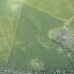
Cropmark(S) (Period Unknown), Standing Stone (Prehistoric)
Site Name Lendrick Lodge
Classification Cropmark(S) (Period Unknown), Standing Stone (Prehistoric)
Canmore ID 32308
Site Number NO35SE 25
NGR NO 35043 50418
Datum OSGB36 - NGR
Permalink http://canmore.org.uk/site/32308


- Council Angus
- Parish Airlie
- Former Region Tayside
- Former District Angus
- Former County Angus
NO35SE 25 3505 5042.
(NO 3505 5042) Standing Stone (NR).
OS 6" map, Forfarshire and Angus. 2nd ed., (1926)
A standing stone about 5' high, 2' broad and 1' thick.
The area of the stone was investigated some years before 1856 and "a circle of common land stones was found near its base, but no trace of sepulchral or other remains" (Jervise 1859).
Name Book 1863; A Jervise 1859.
This unsculptured standing stone is situated on the edge of a ridge overlooking a morass on the south. It stands 1.8m high, by 0.7m by 0.5m. Part of its top has been broken off leaving a pointed portion on the west side.
Visited by OS (JLD) 15 September 1958.
This standing stone is as described in the report of 15 September 1958. Surveyed at 1:2500.
Visited by OS (TRG) 7 January 1977.
In August 1987 the standing stone was reported to have fallen and a limited excavation of the stone hole revealed nothing of significance. The stone measured 2.35m long and c.1.83m in circumference. It was re-erected.
Information from G J Barclay, SDD Ancient Monuments Inspectorate 23 September 1987.
It was reported to SDD:HBM in August 1987 that this stone had fallen. Arrangements were made to excavate the stone hole and re-erect the stone in early September. The stone was situated immediately below the crest of a low ridge. It had fallen to the NNE (slightly uphill), revealing a partly soil filled and eroded socket.
The stone hole measured 1.2m in diameter and 0.4m to 0.5m deep. There was no stone packing in the hole and no burnt bone or artefacts were recovered. The stone measured 2.35m long and c 1.83m in circumference. The base was flat. Earlier records of the stone put the height of its tip above ground level at between 1.5m (Jervise 1859) and 1.8m (OS field report 1958). It seems certain that the stone had fallen because the proportion of the stone set below ground had been reduced by the erosion of soil by ploughing around the stone.
The stone was re-erected by the author and the farmer, Mr Patullo, who provided plant. The stone is now set c.0.55m into the ground in a socket packed with concrete, stones and gravel. While every effort was made to re-erect the stone on its original orientation (it has a very pronounced offset tip), it is likely that its orientation has been changed slightly.
G J Barclay 1987.
Note (1983)
Lendrick Lodge NO 350 504 NO35SE 25
This standing stone, which measures 0.7m by 0.5m and 1.8m in height, is situated on a low ridge 200m S of Lendrick Lodge.
RCAHMS 1983.
(Name Book, Forfar, No. 2, p. 32; Jervise 1857b, 247).
Excavation (1987)
In August 1987 the standing stone was reported to have fallen and a limited excavation of the stone hole revealed nothing of significance. The stone measured 2.35m long and c.1.83m in circumference. It was re-erected.
Information from G J Barclay, SDD Ancient Monuments Inspectorate 23 September 1987.

