
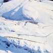
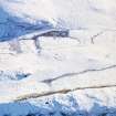
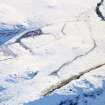
Castle Hill


Ring Ditch House (Prehistoric)
Site Name Castle Hill
Classification Ring Ditch House (Prehistoric)
Canmore ID 32200
Site Number NO35NE 33
NGR NO 36204 56737
Datum OSGB36 - NGR
Permalink http://canmore.org.uk/site/32200


- Council Angus
- Parish Kirriemuir
- Former Region Tayside
- Former District Angus
- Former County Angus
Note (1983)
Castle Hill NO 361 567 NO35NE
This ring-ditch house is situated on a terrace SE of the summit of Castle Hill. The ditch is up to 2m broad by 0.3m deep, and there ·is a wall 1.7m thick on its outer lip; within its ditch the house measures about 9.5m in diameter, and the entrance is on the SE, where the wall thickness increases to 3m. There is a small cairn 2m in diameter on a knoll to the SE, but it is probably of relatively recent date.
RCAHMS 1983.

