Accessibility

Font Size

100% 150% 200%

Background Colour

Default Contrast
Close Reset

Castle Hill

Rig And Furrow (Medieval) - (Post Medieval)

Site Name Castle Hill

Classification Rig And Furrow (Medieval) - (Post Medieval)

Canmore ID 32195

Site Number NO35NE 29

NGR NO 361 565

Datum OSGB36 - NGR

Permalink http://canmore.org.uk/site/32195

Ordnance Survey licence number AC0000807262. All rights reserved.
Canmore Disclaimer. © Bluesky International Limited 2025. Public Sector Viewing Terms

Toggle Aerial | View on large map

Digital Images

Oblique aerial view of Castle Hill centred on the remains of a ring-ditch house with a fort, mound and rig adjacent, taken from the NW.
Oblique aerial view of Castle Hill centred on the remains of a ring-ditch house with a fort, mound and rig adjacent, taken from the NW.Castle Hill, NO35NE 29, Ordnance Survey index card, RectoCastle Hill, NO35NE 29, Ordnance Survey index card, Recto

Administrative Areas

  • Council Angus
  • Parish Kirriemuir
  • Former Region Tayside
  • Former District Angus
  • Former County Angus

Archaeology Notes

NO35NE 29 361 565.

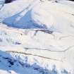
A plot of rig and furrow survives on the southern slopes of Castle Hill.

J R Sherriff 1982.

References

MyCanmore Image Contributions


Contribute an Image

MyCanmore Text Contributions