Pricing Change
New pricing for orders of material from this site will come into place shortly. Charges for supply of digital images, digitisation on demand, prints and licensing will be altered.
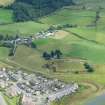
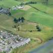
Old Town Of Leys
Dyke (Period Unassigned), Field Drain(S) (Period Unassigned), Pit(S) (Neolithic), Unidentified Flint (Period Unassigned), Unidentified Pottery (Period Unassigned)
Site Name Old Town Of Leys
Classification Dyke (Period Unassigned), Field Drain(S) (Period Unassigned), Pit(S) (Neolithic), Unidentified Flint (Period Unassigned), Unidentified Pottery (Period Unassigned)
Canmore ID 320608
Site Number NH64SE 566
NGR NH 66680 41420
Datum OSGB36 - NGR
Permalink http://canmore.org.uk/site/320608
- Council Highland
- Parish Inverness And Bona
- Former Region Highland
- Former District Inverness
- Former County Inverness-shire
Watching Brief (December 2010 - January 2011)
NH 6668 4142 A watching brief was undertaken December 2010–January 2011 at Culduthel, SW of Inverness. The site is S of Culduthel Mains Avenue and c50m S of the high status Iron Age metalworking site excavated by Headland Archaeology (DES 2010, 96; 2009, 100). A total of 28 features were identified including a hearth, pits and evidence for an old ground surface; 16 pits were located in a distinct group and many contained Neolithic pottery and associated lithics.
The group of 16 pits, which were of various shapes and depths, were located on a flat terrace at 67–68m OD, in the area of the gravel grading compound. The recovered pottery indicated that six of the pits were certainly related. An examination of the pits morphology and spatial distribution suggested that another five features probably related to this group. Apart from one flint flake, which was recovered from a pit in the flood relief channel, the entire assemblage of small finds was recovered from pits in the gravel grading compound. Although no fully intact pots were recovered, there was an unusual mixture of styles (representing at least 13 pots) and both Early to Middle Neolithic style and Late Neolithic Grooved Ware. Samples of charcoal from two of the pits containing prehistoric pottery and lithics were radiocarbon dated and returned dates of 4365±30 BP (3090–2900 cal BC at 2s ) and 4335±30 BP (3030–2890 cal BC at 2s).
Archive: RCAHMS (intended). Report: Highland HER
Funder: Global Construction Ltd
Ross and Cromarty Archaeological Services, 2011
Information also reported in Oasis (rosscrom1-111010) 9 February 2012


