Scheduled Maintenance
Please be advised that this website will undergo scheduled maintenance on the following dates: •
Tuesday 12th November from 11:00-15:00 & Thursday 14th November from 11:00-15:00
During these times, some services may be temporarily unavailable. We apologise for any inconvenience this may cause.
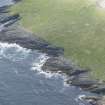
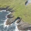
Rona, Fianuis
Building (Period Unassigned), Enclosure (Period Unassigned)
Site Name Rona, Fianuis
Classification Building (Period Unassigned), Enclosure (Period Unassigned)
Alternative Name(s) North Rona; Rona Ronaidh
Canmore ID 320016
Site Number HW83SW 20
NGR HW 81382 33012
Datum OSGB36 - NGR
Permalink http://canmore.org.uk/site/320016
- Council Western Isles
- Parish Barvas
- Former Region Western Isles Islands Area
- Former District Western Isles
- Former County Ross And Cromarty
Field Visit (3 July 2009)
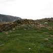
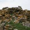
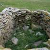
This small building, which is probably the ruin shown on the 1st edition OS 6-inch map (Ross-shire, Island of Lewis sheet 47), stands on the line of an older enclosure wall and partly occupies the site of an earlier building lying within the enclosure. Extensively rebuilt, probably for use as a bothy, this later building is now collapsing, but the walls stand up to 1.7m above the roughly paved floor in the interior, which is subrectangular on plan and measures 3.8m from NW to SE by 2.2m transversely. A large block tucked into the corner on the SW side of the entrance in the SE end provides a shelf 0.3m above the floor. The entrance, which measures 0.45m wide by 0.8m high, retains its stone lintel and is protected externally by thick baffle walls to create a sheltered enclosure 2.7m long by 2.1m broad. The outer face of the bothy is fairly ramshackle, formed of piled up and pitched stones. The earlier building has been heavily robbed, though part of it has been rebuilt into possibly a small outhouse to the bothy measuring 1.6m by 1.2m internally. Nevertheless, the curved external shape of its S end, part of the inner face, and a possible external kerb of boulders immediately NE of the bothy, suggest that it was a thick-walled structure some 4.2m in internal length. The surrounding enclosure measures about 40m by 35m internally, but it appears to have been reconstructed at some stage, and the presence of a second wall-line on the ESE suggests that it was once about 45m in length. Several other stony banks can be seen in the vicinity but they do not form any coherent enclosures.
Visited by RCAHMS (SH, DCC) 3 July 2009


