
Pricing Change
New pricing for orders of material from this site will come into place shortly. Charges for supply of digital images, digitisation on demand, prints and licensing will be altered.
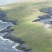
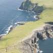
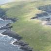
Rona, Fianuis


Building (Period Unassigned), Enclosure (Period Unassigned)
Site Name Rona, Fianuis
Classification Building (Period Unassigned), Enclosure (Period Unassigned)
Alternative Name(s) North Rona; Rona Ronaidh
Canmore ID 320015
Site Number HW83SW 19
NGR HW 81472 32916
Datum OSGB36 - NGR
Permalink http://canmore.org.uk/site/320015


- Council Western Isles
- Parish Barvas
- Former Region Western Isles Islands Area
- Former District Western Isles
- Former County Ross And Cromarty
Field Visit (3 July 2009)
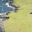
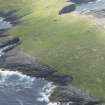
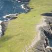
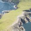
This small building is situated on the NE side of a massive boulder about 2.5m high, which lies towards the E side of Fianuis close to the landing place. The drystone walls of the building have by and large collapsed outwards, but they are some 1.1m thick and stand up to 1m in height externally on the N, butting onto the boulder at S and W corners. The interior, which measures about 3.1m from NE to SW by 2.8m transversely, is choked with stones, many of which are deliberately laid flat, and the original floor lies some depth below. What the secondary use of this laid surface has been is not known, but a stone set in concrete at the W corner of the interior and a galvanised angle-iron cemented into the SW side of the boulder suggest that it was formed relatively recently. The building also lies at the upper end of a small enclosure, which drops down SE beside a dry burn. Measuring about 20m by 15m internally, its wall was originally composed of upright boulders infilled with smaller stones, but many of the uprights are now lying flat. The enclosure and the boulder are shown on the 1st edition OS 6-inch map (Ross-shire, Island of Lewis sheet 47).
Visited by RCAHMS (SH, DCC) 3 July 2009

