Pricing Change
New pricing for orders of material from this site will come into place shortly. Charges for supply of digital images, digitisation on demand, prints and licensing will be altered.
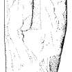
Rona, St Ronan's Church, Cross 2
Cross Incised Stone (Early Medieval)
Site Name Rona, St Ronan's Church, Cross 2
Classification Cross Incised Stone (Early Medieval)
Alternative Name(s) North Rona; Rona Ronaidh; Teampall Ronain
Canmore ID 319422
Site Number HW83SW 1.02
NGR HW 8091 3231
Datum OSGB36 - NGR
Permalink http://canmore.org.uk/site/319422
- Council Western Isles
- Parish Barvas
- Former Region Western Isles Islands Area
- Former District Western Isles
- Former County Ross And Cromarty
Ground Survey (1958)
In summer 1958 a party from Glasgow University carried out a detailed ground survey of the ecclesiastical and domestic structures on North Rona. The village is situated towards the NW corner of an infield of about 20 acres, cultivated in large lazybeds. The pattern of domestic architecture is of a central rectangular courtyard about 30ft by 10ft, surrounded by a variable arrangement of low covered passages and small circular or oval corbelled cells. Two such steadings are built close against the outside of the chapel enclosure wall, on the S side; a third stands apart, a little to the south.
Saint Ronan’s cell and chapel stand in the SE corner of a roughly oval enclosure bounded by a heavy stone and turf wall. The small rectangular cell, almost certainly built before 900 AD, is well preserved, while the medieval chapel which was added to form a nave to it is of more elaborate design and inferior execution.
The houses were occupied as least as late as 1683, and all show signs of reconstruction. A lower limit for the date of human settlement has not been established.
H Nisbet, Discovery and Excavation in Scotland, 1958
Reference (2001)
(2) Tapered slab of gneiss with slightly rounded top, 1.17m by 0.51m in maximum width and flaked in places. It was found in 1958 built into the N wall of the chapel, and after recording it was replaced there, face downwards. It bears a sunken Latin cross with arms 50mm to 60mm wide and having slightly expanded terminals. This measures 0.47m high and about 0.3m in probable span but has flaked at the ends of both side-arms.
(H C Nisbet and R A Gailey 1960, 109-10 and pl.17B opp.p.109; rubbing in NMRS, MS 433).
I Fisher 2001


