Following the launch of trove.scot in February 2025 we are now planning the retiral of some of our webservices. Canmore will be switched off on 24th June 2025. Information about the closure can be found on the HES website: Retiral of HES web services | Historic Environment Scotland
Rum, Harris
Building(S) (Post Medieval), Cultivation Remains (Post Medieval), Enclosure (Post Medieval)
Site Name Rum, Harris
Classification Building(S) (Post Medieval), Cultivation Remains (Post Medieval), Enclosure (Post Medieval)
Canmore ID 318590
Site Number NM39NW 8.02
NGR NM 33848 95845
Datum OSGB36 - NGR
Permalink http://canmore.org.uk/site/318590
- Council Highland
- Parish Small Isles
- Former Region Highland
- Former District Lochaber
- Former County Inverness-shire
Measured Survey (23 August 2011)
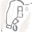
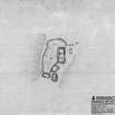
A plan of four buildings and an enclosure centred at NM 3385 9584, part of the township of Harris (NM93NW 8), was undertaken at a scale of 1:250 using a plane table and self-reducing alidade. The plan was later used as the basis for an illustration published in 2016 at a scale of 1:500 (Hunter, fig. 5.27).
Visited by RCAHMS (GFG, IP) 23 August 2011.
Field Visit (23 August 2011)
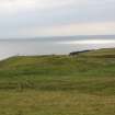
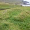
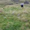
This group of four buildings and an enclosure is situated on a grass-grown ridge within the large township of Harris (NM39NW 8), about 50m SW of the main concentration of structures.
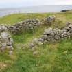
The largest building is rectangular on plan, measuring 14m from N to S by 6.5m transversely overall and has rounded corners. The walls are built in drystone, collected from the adjacent river, and the external face is slightly battered. They measure 1.2m in thickness at the base, and up to 0.8m in height. There is an entrance in the E wall, and an interior wall, which may or may not be part of the original build, separates the building into two compartments. A later compartment has been formed by the construction of a smaller structure over the southern third of the building.
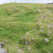
Immediately to the SSW are the grass-grown footings of a smaller rectangular building with rounded external corners, which measures 7.5m from NE to SW by 5.5m transversely. The walls are up to 1m in thickness and 0.5m in height, and there is an entrance at the SE. The building may overlie an earlier phase, represented by the outer face of an earlier wall which is visible at the E corner. The SW wall of this building appears to have been constructed to allow movement between it and a third to the S. This third building is oval and measures about 6.5m from NNW to SSE by 5m transversely, with a rectangular interior. The walls measure about 1m in thickness and up to 0.8m in height, and there is an entrance in the NNW 0.3m wide. The external face of an earlier underlying building, aligned from N to S, is visible at the E side and S end.
A fourth building stands just to the W. Rectangular in plan, it measures 7m from WNW to ESE by 4.5m transversely and has rounded corners. The drystone walls measure up to 0.9m in thickness and 0.8m in height and there is an entrance to the S.
An enclosure is attached to the largest building at the SW corner, taking in an area that measures 30m from NNE to SSW by 15m transversely at the widest point. The turf and stone enclosure wall overlies the second and fourth building, which have been partially robbed for its construction. A depression in the ground just E of the largest building is probably a midden pit.
Two buildings, one of which is unroofed, and an enclosure are depicted at this location on the 1st edition OS 6-inch map surveyed in 1877 (Argyllshire (Island of Rum) 1879-80, Sheet LXVI). A single and larger roofed building is shown on the 2nd edition (Inverness-shire – Isle of Skye 1903, Sheet LXVI).
Visited by RCAHMS (GG, IP) 23 August 2011
1:250 Plan


