
Pricing Change
New pricing for orders of material from this site will come into place shortly. Charges for supply of digital images, digitisation on demand, prints and licensing will be altered.
Pennymuir


Cairn (Period Unassigned)
Site Name Pennymuir
Classification Cairn (Period Unassigned)
Canmore ID 318246
Site Number NT71SE 186
NGR NT 75501 13551
Datum OSGB36 - NGR
Permalink http://canmore.org.uk/site/318246

- Council Scottish Borders, The
- Parish Oxnam
- Former Region Borders
- Former District Roxburgh
- Former County Roxburghshire
Field Visit (5 November 1999)
NT71SE 186
Pennymuir
Cairn
NT 75501 13551
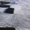
Situated in rough grazing, about 70m to the S of Pennymuir Roman camps (NT71SE 5) there are two subcircular grass-covered stony mounds. Measuring up to 14.4 in diameter and 0.5m in height, they may be the much denuded remains of two cairns.
(KALE99 86,177)
Visited by RCAHMS (KB) 5 November 1999

